You are here: Home > Network List > TA - USArray Transportable Network (new EarthScope stations) Stations List
> Station T26A Comanche National Grassland Park, Kim, CO, USA > Earthquake Result Viewer
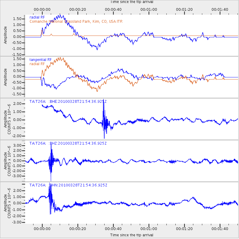
T26A Comanche National Grassland Park, Kim, CO, USA - Earthquake Result Viewer
*The percent match for this event was below the threshold and hence no stack was calculated.
| Earthquake location: |
Near Coast Of Central Chile |
| Earthquake latitude/longitude: |
-35.4/-72.9 |
| Earthquake time(UTC): |
2010/03/28 (087) 21:43:13 GMT |
| Earthquake Depth: |
22 km |
| Earthquake Magnitude: |
5.5 MB, 5.8 MS, 5.7 MW |
| Earthquake Catalog/Contributor: |
WHDF/NEIC |
|
| Network: |
TA USArray Transportable Network (new EarthScope stations) |
| Station: |
T26A Comanche National Grassland Park, Kim, CO, USA |
| Lat/Lon: |
37.17 N/103.59 W |
| Elevation: |
1830 m |
|
| Distance: |
77.6 deg |
| Az: |
335.328 deg |
| Baz: |
154.728 deg |
| Ray Param: |
$rayparam |
*The percent match for this event was below the threshold and hence was not used in the summary stack. |
|
| Radial Match: |
44.154774 % |
| Radial Bump: |
400 |
| Transverse Match: |
29.780405 % |
| Transverse Bump: |
400 |
| SOD ConfigId: |
312771 |
| Insert Time: |
2010-06-28 17:06:27.646 +0000 |
| GWidth: |
2.5 |
| Max Bumps: |
400 |
| Tol: |
0.001 |
|
Signal To Noise
| Channel | StoN | STA | LTA |
| TA:T26A: :BHZ:20100328T21:54:36.925Z | 2.6213298 | 5.0329254E-7 | 1.9199895E-7 |
| TA:T26A: :BHN:20100328T21:54:36.925Z | 2.7521117 | 1.7218192E-6 | 6.2563566E-7 |
| TA:T26A: :BHE:20100328T21:54:36.925Z | 1.4924338 | 1.0146305E-6 | 6.798496E-7 |
| Arrivals |
| Ps | |
| PpPs | |
| PsPs/PpSs | |


