You are here: Home > Network List > US - United States National Seismic Network Stations List
> Station DGMT Dagmar, Montana, USA > Earthquake Result Viewer
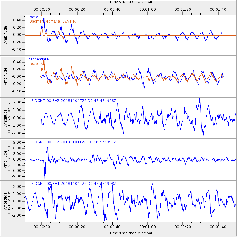
DGMT Dagmar, Montana, USA - Earthquake Result Viewer
*The percent match for this event was below the threshold and hence no stack was calculated.
| Earthquake location: |
Northern Chile |
| Earthquake latitude/longitude: |
-19.6/-69.3 |
| Earthquake time(UTC): |
2018/11/01 (305) 22:19:51 GMT |
| Earthquake Depth: |
102 km |
| Earthquake Magnitude: |
6.2 Mww |
| Earthquake Catalog/Contributor: |
NEIC PDE/us |
|
| Network: |
US United States National Seismic Network |
| Station: |
DGMT Dagmar, Montana, USA |
| Lat/Lon: |
48.47 N/104.20 W |
| Elevation: |
0.0 m |
|
| Distance: |
74.6 deg |
| Az: |
336.734 deg |
| Baz: |
145.971 deg |
| Ray Param: |
$rayparam |
*The percent match for this event was below the threshold and hence was not used in the summary stack. |
|
| Radial Match: |
68.93604 % |
| Radial Bump: |
400 |
| Transverse Match: |
63.008045 % |
| Transverse Bump: |
400 |
| SOD ConfigId: |
3131071 |
| Insert Time: |
2018-11-15 22:29:48.778 +0000 |
| GWidth: |
2.5 |
| Max Bumps: |
400 |
| Tol: |
0.001 |
|
Signal To Noise
| Channel | StoN | STA | LTA |
| US:DGMT:00:BHZ:20181101T22:30:48.474998Z | 26.244637 | 3.7121836E-6 | 1.4144543E-7 |
| US:DGMT:00:BH1:20181101T22:30:48.474998Z | 2.4978876 | 1.2474042E-6 | 4.9938365E-7 |
| US:DGMT:00:BH2:20181101T22:30:48.474998Z | 0.74255913 | 5.1481527E-7 | 6.9329866E-7 |
| Arrivals |
| Ps | |
| PpPs | |
| PsPs/PpSs | |


