You are here: Home > Network List > AZ - ANZA Regional Network Stations List
> Station SMER AZ.SMER > Earthquake Result Viewer
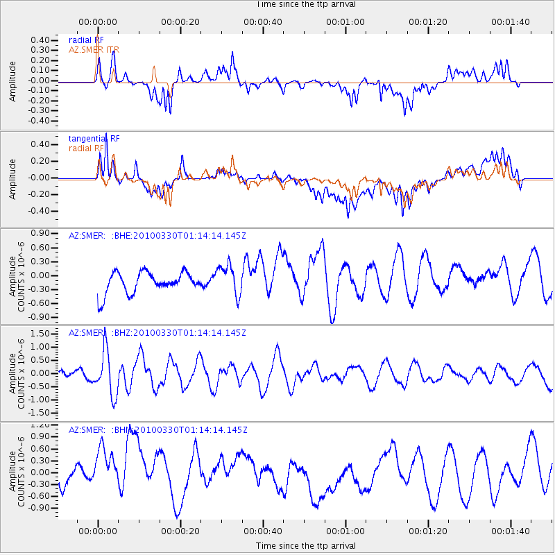
SMER AZ.SMER - Earthquake Result Viewer
*The percent match for this event was below the threshold and hence no stack was calculated.
| Earthquake location: |
Eastern Sea Of Japan |
| Earthquake latitude/longitude: |
43.3/138.4 |
| Earthquake time(UTC): |
2010/03/30 (089) 01:02:53 GMT |
| Earthquake Depth: |
21 km |
| Earthquake Magnitude: |
6.1 MB, 5.3 MS, 5.7 MW, 5.6 MW |
| Earthquake Catalog/Contributor: |
WHDF/NEIC |
|
| Network: |
AZ ANZA Regional Network |
| Station: |
SMER AZ.SMER |
| Lat/Lon: |
33.46 N/117.17 W |
| Elevation: |
355 m |
|
| Distance: |
77.1 deg |
| Az: |
56.14 deg |
| Baz: |
313.516 deg |
| Ray Param: |
$rayparam |
*The percent match for this event was below the threshold and hence was not used in the summary stack. |
|
| Radial Match: |
59.401314 % |
| Radial Bump: |
400 |
| Transverse Match: |
61.581978 % |
| Transverse Bump: |
400 |
| SOD ConfigId: |
312771 |
| Insert Time: |
2010-06-28 17:14:22.438 +0000 |
| GWidth: |
2.5 |
| Max Bumps: |
400 |
| Tol: |
0.001 |
|
Signal To Noise
| Channel | StoN | STA | LTA |
| AZ:SMER: :BHZ:20100330T01:14:14.145Z | 2.971094 | 8.6218836E-7 | 2.9019222E-7 |
| AZ:SMER: :BHN:20100330T01:14:14.145Z | 1.712765 | 8.71825E-7 | 5.090161E-7 |
| AZ:SMER: :BHE:20100330T01:14:14.145Z | 1.4994085 | 3.370313E-7 | 2.2477617E-7 |
| Arrivals |
| Ps | |
| PpPs | |
| PsPs/PpSs | |


