You are here: Home > Network List > CI - Caltech Regional Seismic Network Stations List
> Station FUR Furnace Creek, CA, USA > Earthquake Result Viewer
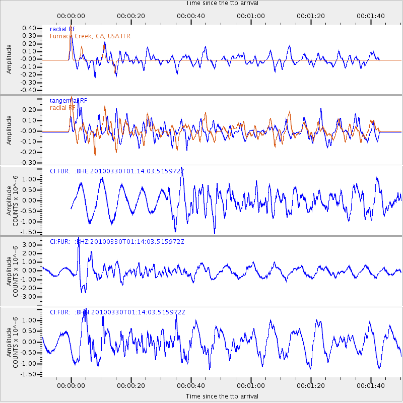
FUR Furnace Creek, CA, USA - Earthquake Result Viewer
*The percent match for this event was below the threshold and hence no stack was calculated.
| Earthquake location: |
Eastern Sea Of Japan |
| Earthquake latitude/longitude: |
43.3/138.4 |
| Earthquake time(UTC): |
2010/03/30 (089) 01:02:53 GMT |
| Earthquake Depth: |
21 km |
| Earthquake Magnitude: |
6.1 MB, 5.3 MS, 5.7 MW, 5.6 MW |
| Earthquake Catalog/Contributor: |
WHDF/NEIC |
|
| Network: |
CI Caltech Regional Seismic Network |
| Station: |
FUR Furnace Creek, CA, USA |
| Lat/Lon: |
36.47 N/116.86 W |
| Elevation: |
-37.0 m |
|
| Distance: |
75.3 deg |
| Az: |
53.712 deg |
| Baz: |
313.111 deg |
| Ray Param: |
$rayparam |
*The percent match for this event was below the threshold and hence was not used in the summary stack. |
|
| Radial Match: |
47.62764 % |
| Radial Bump: |
400 |
| Transverse Match: |
75.646576 % |
| Transverse Bump: |
400 |
| SOD ConfigId: |
312771 |
| Insert Time: |
2010-06-28 17:15:30.523 +0000 |
| GWidth: |
2.5 |
| Max Bumps: |
400 |
| Tol: |
0.001 |
|
Signal To Noise
| Channel | StoN | STA | LTA |
| CI:FUR: :BHZ:20100330T01:14:03.515972Z | 3.0393655 | 1.4587141E-6 | 4.7994035E-7 |
| CI:FUR: :BHN:20100330T01:14:03.515972Z | 2.692938 | 8.074686E-7 | 2.998467E-7 |
| CI:FUR: :BHE:20100330T01:14:03.515972Z | 0.95934916 | 5.551242E-7 | 5.786467E-7 |
| Arrivals |
| Ps | |
| PpPs | |
| PsPs/PpSs | |


