You are here: Home > Network List > CI - Caltech Regional Seismic Network Stations List
> Station SWS Sam W. Stewart, Westmorland, CA, USA > Earthquake Result Viewer
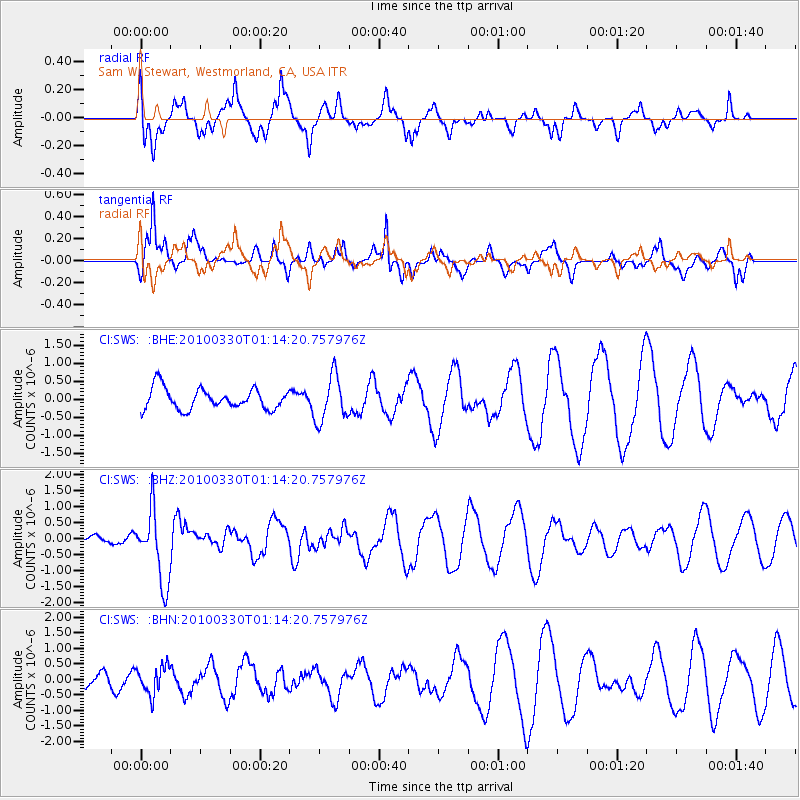
SWS Sam W. Stewart, Westmorland, CA, USA - Earthquake Result Viewer
*The percent match for this event was below the threshold and hence no stack was calculated.
| Earthquake location: |
Eastern Sea Of Japan |
| Earthquake latitude/longitude: |
43.3/138.4 |
| Earthquake time(UTC): |
2010/03/30 (089) 01:02:53 GMT |
| Earthquake Depth: |
21 km |
| Earthquake Magnitude: |
6.1 MB, 5.3 MS, 5.7 MW, 5.6 MW |
| Earthquake Catalog/Contributor: |
WHDF/NEIC |
|
| Network: |
CI Caltech Regional Seismic Network |
| Station: |
SWS Sam W. Stewart, Westmorland, CA, USA |
| Lat/Lon: |
32.94 N/115.80 W |
| Elevation: |
140 m |
|
| Distance: |
78.3 deg |
| Az: |
55.703 deg |
| Baz: |
314.172 deg |
| Ray Param: |
$rayparam |
*The percent match for this event was below the threshold and hence was not used in the summary stack. |
|
| Radial Match: |
70.52451 % |
| Radial Bump: |
359 |
| Transverse Match: |
75.898224 % |
| Transverse Bump: |
351 |
| SOD ConfigId: |
312771 |
| Insert Time: |
2010-06-28 17:15:50.116 +0000 |
| GWidth: |
2.5 |
| Max Bumps: |
400 |
| Tol: |
0.001 |
|
Signal To Noise
| Channel | StoN | STA | LTA |
| CI:SWS: :BHZ:20100330T01:14:20.757976Z | 2.8438354 | 1.1319063E-6 | 3.9802103E-7 |
| CI:SWS: :BHN:20100330T01:14:20.757976Z | 2.2791288 | 4.5072903E-7 | 1.9776373E-7 |
| CI:SWS: :BHE:20100330T01:14:20.757976Z | 2.1881154 | 6.298162E-7 | 2.87835E-7 |
| Arrivals |
| Ps | |
| PpPs | |
| PsPs/PpSs | |


