You are here: Home > Network List > IW - Intermountain West Stations List
> Station IMW Indian Meadow, Wyoming, USA > Earthquake Result Viewer
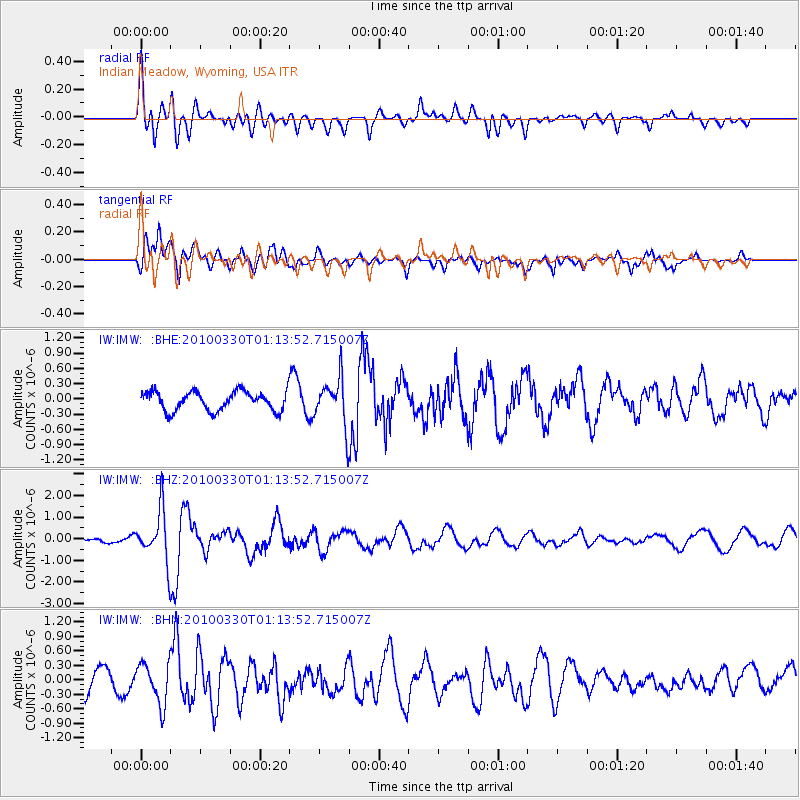
IMW Indian Meadow, Wyoming, USA - Earthquake Result Viewer
*The percent match for this event was below the threshold and hence no stack was calculated.
| Earthquake location: |
Eastern Sea Of Japan |
| Earthquake latitude/longitude: |
43.3/138.4 |
| Earthquake time(UTC): |
2010/03/30 (089) 01:02:53 GMT |
| Earthquake Depth: |
21 km |
| Earthquake Magnitude: |
6.1 MB, 5.3 MS, 5.7 MW, 5.6 MW |
| Earthquake Catalog/Contributor: |
WHDF/NEIC |
|
| Network: |
IW Intermountain West |
| Station: |
IMW Indian Meadow, Wyoming, USA |
| Lat/Lon: |
43.90 N/110.94 W |
| Elevation: |
2646 m |
|
| Distance: |
73.4 deg |
| Az: |
44.891 deg |
| Baz: |
314.541 deg |
| Ray Param: |
$rayparam |
*The percent match for this event was below the threshold and hence was not used in the summary stack. |
|
| Radial Match: |
74.45943 % |
| Radial Bump: |
400 |
| Transverse Match: |
72.73473 % |
| Transverse Bump: |
400 |
| SOD ConfigId: |
312771 |
| Insert Time: |
2010-06-28 17:20:53.594 +0000 |
| GWidth: |
2.5 |
| Max Bumps: |
400 |
| Tol: |
0.001 |
|
Signal To Noise
| Channel | StoN | STA | LTA |
| IW:IMW: :BHZ:20100330T01:13:52.715007Z | 5.96765 | 1.1690333E-6 | 1.9589508E-7 |
| IW:IMW: :BHN:20100330T01:13:52.715007Z | 1.307747 | 4.24378E-7 | 3.2451075E-7 |
| IW:IMW: :BHE:20100330T01:13:52.715007Z | 2.5019817 | 4.683649E-7 | 1.8719757E-7 |
| Arrivals |
| Ps | |
| PpPs | |
| PsPs/PpSs | |


