You are here: Home > Network List > US - United States National Seismic Network Stations List
> Station LAO LASA Array, Montana, USA > Earthquake Result Viewer
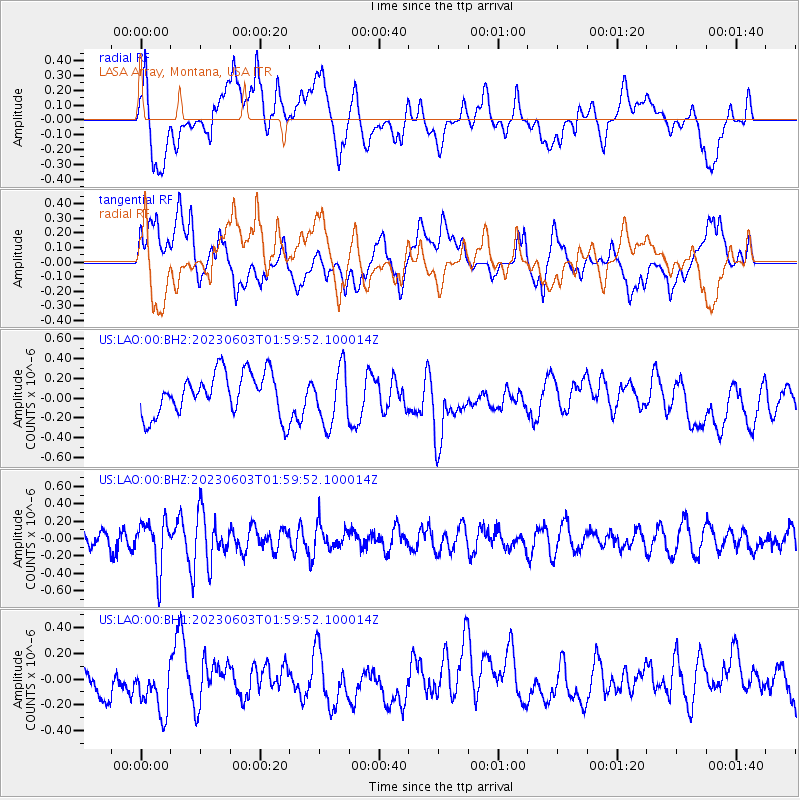
LAO LASA Array, Montana, USA - Earthquake Result Viewer
*The percent match for this event was below the threshold and hence no stack was calculated.
| Earthquake location: |
Southern Peru |
| Earthquake latitude/longitude: |
-15.7/-71.7 |
| Earthquake time(UTC): |
2023/06/03 (154) 01:49:15 GMT |
| Earthquake Depth: |
10 km |
| Earthquake Magnitude: |
5.5 Mww |
| Earthquake Catalog/Contributor: |
NEIC PDE/us |
|
| Network: |
US United States National Seismic Network |
| Station: |
LAO LASA Array, Montana, USA |
| Lat/Lon: |
46.69 N/106.22 W |
| Elevation: |
902 m |
|
| Distance: |
69.4 deg |
| Az: |
335.399 deg |
| Baz: |
144.38 deg |
| Ray Param: |
$rayparam |
*The percent match for this event was below the threshold and hence was not used in the summary stack. |
|
| Radial Match: |
55.824257 % |
| Radial Bump: |
400 |
| Transverse Match: |
45.704544 % |
| Transverse Bump: |
400 |
| SOD ConfigId: |
30536071 |
| Insert Time: |
2023-06-17 02:12:16.583 +0000 |
| GWidth: |
2.5 |
| Max Bumps: |
400 |
| Tol: |
0.001 |
|
Signal To Noise
| Channel | StoN | STA | LTA |
| US:LAO:00:BHZ:20230603T01:59:52.100014Z | 4.0269475 | 2.7480277E-7 | 6.824096E-8 |
| US:LAO:00:BH1:20230603T01:59:52.100014Z | 1.4482279 | 2.1335833E-7 | 1.4732372E-7 |
| US:LAO:00:BH2:20230603T01:59:52.100014Z | 1.3201247 | 2.826756E-7 | 2.1412792E-7 |
| Arrivals |
| Ps | |
| PpPs | |
| PsPs/PpSs | |


