You are here: Home > Network List > GS - US Geological Survey Networks Stations List
> Station KAN08 Anthony NE Station > Earthquake Result Viewer
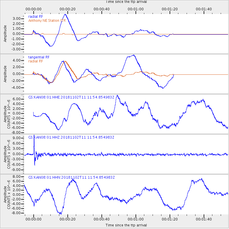
KAN08 Anthony NE Station - Earthquake Result Viewer
*The percent match for this event was below the threshold and hence no stack was calculated.
| Earthquake location: |
Northwest Of Kuril Islands |
| Earthquake latitude/longitude: |
47.8/146.7 |
| Earthquake time(UTC): |
2018/11/02 (306) 11:01:15 GMT |
| Earthquake Depth: |
432 km |
| Earthquake Magnitude: |
5.9 Mww |
| Earthquake Catalog/Contributor: |
NEIC PDE/us |
|
| Network: |
GS US Geological Survey Networks |
| Station: |
KAN08 Anthony NE Station |
| Lat/Lon: |
37.23 N/97.97 W |
| Elevation: |
375 m |
|
| Distance: |
77.6 deg |
| Az: |
47.634 deg |
| Baz: |
321.401 deg |
| Ray Param: |
$rayparam |
*The percent match for this event was below the threshold and hence was not used in the summary stack. |
|
| Radial Match: |
35.922325 % |
| Radial Bump: |
400 |
| Transverse Match: |
30.856277 % |
| Transverse Bump: |
400 |
| SOD ConfigId: |
3131071 |
| Insert Time: |
2018-11-16 11:10:43.092 +0000 |
| GWidth: |
2.5 |
| Max Bumps: |
400 |
| Tol: |
0.001 |
|
Signal To Noise
| Channel | StoN | STA | LTA |
| GS:KAN08:01:HHZ:20181102T11:11:54.854983Z | 11.673359 | 2.7145497E-6 | 2.325423E-7 |
| GS:KAN08:01:HHN:20181102T11:11:54.854983Z | 0.8188648 | 3.015343E-6 | 3.682345E-6 |
| GS:KAN08:01:HHE:20181102T11:11:54.854983Z | 0.6716661 | 1.9475226E-6 | 2.8995396E-6 |
| Arrivals |
| Ps | |
| PpPs | |
| PsPs/PpSs | |


