You are here: Home > Network List > GS - US Geological Survey Networks Stations List
> Station KAN10 Keim Farm > Earthquake Result Viewer
KAN10 Keim Farm - Earthquake Result Viewer

| Earthquake location: |
Northwest Of Kuril Islands |
| Earthquake latitude/longitude: |
47.8/146.7 |
| Earthquake time(UTC): |
2018/11/02 (306) 11:01:15 GMT |
| Earthquake Depth: |
432 km |
| Earthquake Magnitude: |
5.9 Mww |
| Earthquake Catalog/Contributor: |
NEIC PDE/us |
|
| Network: |
GS US Geological Survey Networks |
| Station: |
KAN10 Keim Farm |
| Lat/Lon: |
37.12 N/98.10 W |
| Elevation: |
417 m |
|
| Distance: |
77.6 deg |
| Az: |
47.779 deg |
| Baz: |
321.357 deg |
| Ray Param: |
0.04895389 |
| Estimated Moho Depth: |
40.5 km |
| Estimated Crust Vp/Vs: |
1.83 |
| Assumed Crust Vp: |
6.426 km/s |
| Estimated Crust Vs: |
3.512 km/s |
| Estimated Crust Poisson's Ratio: |
0.29 |
|
| Radial Match: |
97.82807 % |
| Radial Bump: |
128 |
| Transverse Match: |
97.555954 % |
| Transverse Bump: |
150 |
| SOD ConfigId: |
3131071 |
| Insert Time: |
2018-11-16 11:10:45.251 +0000 |
| GWidth: |
2.5 |
| Max Bumps: |
400 |
| Tol: |
0.001 |
|
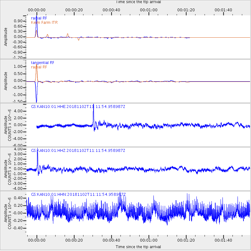
Signal To Noise
| Channel | StoN | STA | LTA |
| GS:KAN10:01:HHZ:20181102T11:11:54.958987Z | 6.3374662 | 1.0414848E-6 | 1.6433772E-7 |
| GS:KAN10:01:HHN:20181102T11:11:54.958987Z | 0.8692241 | 1.1452632E-7 | 1.3175696E-7 |
| GS:KAN10:01:HHE:20181102T11:11:54.958987Z | 6.294039 | 1.4739044E-6 | 2.3417465E-7 |
| Arrivals |
| Ps | 5.4 SECOND |
| PpPs | 17 SECOND |
| PsPs/PpSs | 23 SECOND |


