You are here: Home > Network List > TA - USArray Transportable Network (new EarthScope stations) Stations List
> Station MDND Maddock, ND, USA > Earthquake Result Viewer
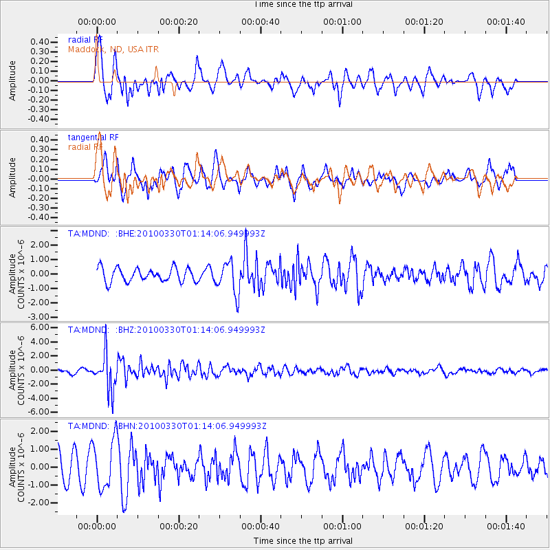
MDND Maddock, ND, USA - Earthquake Result Viewer
*The percent match for this event was below the threshold and hence no stack was calculated.
| Earthquake location: |
Eastern Sea Of Japan |
| Earthquake latitude/longitude: |
43.3/138.4 |
| Earthquake time(UTC): |
2010/03/30 (089) 01:02:53 GMT |
| Earthquake Depth: |
21 km |
| Earthquake Magnitude: |
6.1 MB, 5.3 MS, 5.7 MW, 5.6 MW |
| Earthquake Catalog/Contributor: |
WHDF/NEIC |
|
| Network: |
TA USArray Transportable Network (new EarthScope stations) |
| Station: |
MDND Maddock, ND, USA |
| Lat/Lon: |
47.85 N/99.60 W |
| Elevation: |
479 m |
|
| Distance: |
75.9 deg |
| Az: |
36.084 deg |
| Baz: |
320.329 deg |
| Ray Param: |
$rayparam |
*The percent match for this event was below the threshold and hence was not used in the summary stack. |
|
| Radial Match: |
70.83641 % |
| Radial Bump: |
400 |
| Transverse Match: |
67.0164 % |
| Transverse Bump: |
400 |
| SOD ConfigId: |
312771 |
| Insert Time: |
2010-06-28 17:34:36.202 +0000 |
| GWidth: |
2.5 |
| Max Bumps: |
400 |
| Tol: |
0.001 |
|
Signal To Noise
| Channel | StoN | STA | LTA |
| TA:MDND: :BHZ:20100330T01:14:06.949993Z | 9.542165 | 2.652543E-6 | 2.7798126E-7 |
| TA:MDND: :BHN:20100330T01:14:06.949993Z | 1.8559359 | 1.3542522E-6 | 7.2968686E-7 |
| TA:MDND: :BHE:20100330T01:14:06.949993Z | 2.4355567 | 1.1363582E-6 | 4.6657019E-7 |
| Arrivals |
| Ps | |
| PpPs | |
| PsPs/PpSs | |


