You are here: Home > Network List > CI - Caltech Regional Seismic Network Stations List
> Station LRL Laurel Mtn Radio Fac, Ridgecrest, CA, USA > Earthquake Result Viewer
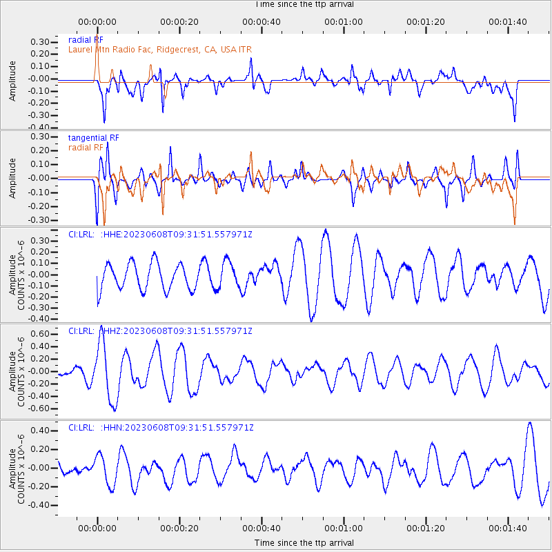
LRL Laurel Mtn Radio Fac, Ridgecrest, CA, USA - Earthquake Result Viewer
*The percent match for this event was below the threshold and hence no stack was calculated.
| Earthquake location: |
Southeast Of Loyalty Islands |
| Earthquake latitude/longitude: |
-22.4/170.3 |
| Earthquake time(UTC): |
2023/06/08 (159) 09:19:28 GMT |
| Earthquake Depth: |
18 km |
| Earthquake Magnitude: |
5.7 mww |
| Earthquake Catalog/Contributor: |
NEIC PDE/us |
|
| Network: |
CI Caltech Regional Seismic Network |
| Station: |
LRL Laurel Mtn Radio Fac, Ridgecrest, CA, USA |
| Lat/Lon: |
35.48 N/117.68 W |
| Elevation: |
1340 m |
|
| Distance: |
89.2 deg |
| Az: |
50.942 deg |
| Baz: |
241.736 deg |
| Ray Param: |
$rayparam |
*The percent match for this event was below the threshold and hence was not used in the summary stack. |
|
| Radial Match: |
68.204025 % |
| Radial Bump: |
400 |
| Transverse Match: |
61.14883 % |
| Transverse Bump: |
400 |
| SOD ConfigId: |
30536071 |
| Insert Time: |
2023-06-22 09:28:04.714 +0000 |
| GWidth: |
2.5 |
| Max Bumps: |
400 |
| Tol: |
0.001 |
|
Signal To Noise
| Channel | StoN | STA | LTA |
| CI:LRL: :HHZ:20230608T09:31:51.557971Z | 3.1989436 | 4.8166413E-7 | 1.5056975E-7 |
| CI:LRL: :HHN:20230608T09:31:51.557971Z | 0.9870366 | 1.6094795E-7 | 1.6306177E-7 |
| CI:LRL: :HHE:20230608T09:31:51.557971Z | 1.0291771 | 1.18428616E-7 | 1.1507118E-7 |
| Arrivals |
| Ps | |
| PpPs | |
| PsPs/PpSs | |


