You are here: Home > Network List > US - United States National Seismic Network Stations List
> Station HAWA Hanford, Washington, USA > Earthquake Result Viewer
HAWA Hanford, Washington, USA - Earthquake Result Viewer
*The percent match for this event was below the threshold and hence no stack was calculated.
| Earthquake location: |
Eastern Sea Of Japan |
| Earthquake latitude/longitude: |
43.3/138.4 |
| Earthquake time(UTC): |
2010/03/30 (089) 01:02:53 GMT |
| Earthquake Depth: |
21 km |
| Earthquake Magnitude: |
6.1 MB, 5.3 MS, 5.7 MW, 5.6 MW |
| Earthquake Catalog/Contributor: |
WHDF/NEIC |
|
| Network: |
US United States National Seismic Network |
| Station: |
HAWA Hanford, Washington, USA |
| Lat/Lon: |
46.39 N/119.53 W |
| Elevation: |
364 m |
|
| Distance: |
67.2 deg |
| Az: |
47.234 deg |
| Baz: |
309.253 deg |
| Ray Param: |
$rayparam |
*The percent match for this event was below the threshold and hence was not used in the summary stack. |
|
| Radial Match: |
63.873055 % |
| Radial Bump: |
400 |
| Transverse Match: |
54.577507 % |
| Transverse Bump: |
400 |
| SOD ConfigId: |
312771 |
| Insert Time: |
2010-06-28 17:59:10.697 +0000 |
| GWidth: |
2.5 |
| Max Bumps: |
400 |
| Tol: |
0.001 |
|
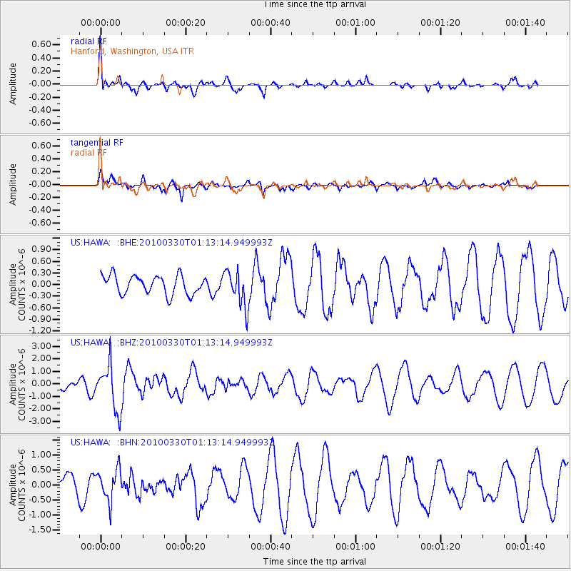
Signal To Noise
| Channel | StoN | STA | LTA |
| US:HAWA: :BHZ:20100330T01:13:14.949993Z | 3.1038976 | 1.8584414E-6 | 5.9874446E-7 |
| US:HAWA: :BHN:20100330T01:13:14.949993Z | 1.1014727 | 5.3019096E-7 | 4.8134734E-7 |
| US:HAWA: :BHE:20100330T01:13:14.949993Z | 1.9882182 | 4.7974623E-7 | 2.4129454E-7 |
| Arrivals |
| Ps | |
| PpPs | |
| PsPs/PpSs | |


