You are here: Home > Network List > US - United States National Seismic Network Stations List
> Station DGMT Dagmar, Montana, USA > Earthquake Result Viewer
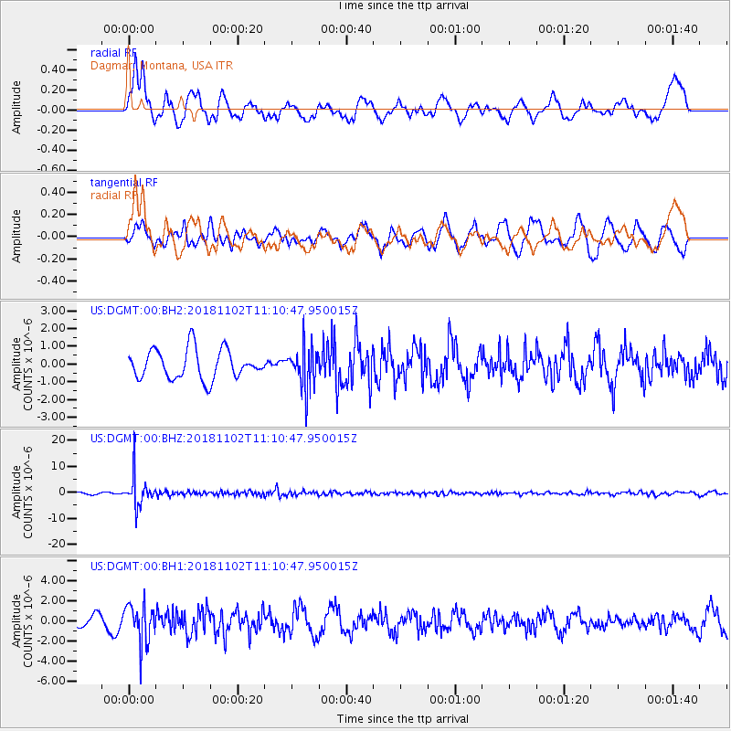
DGMT Dagmar, Montana, USA - Earthquake Result Viewer
*The percent match for this event was below the threshold and hence no stack was calculated.
| Earthquake location: |
Northwest Of Kuril Islands |
| Earthquake latitude/longitude: |
47.8/146.7 |
| Earthquake time(UTC): |
2018/11/02 (306) 11:01:15 GMT |
| Earthquake Depth: |
432 km |
| Earthquake Magnitude: |
5.9 Mww |
| Earthquake Catalog/Contributor: |
NEIC PDE/us |
|
| Network: |
US United States National Seismic Network |
| Station: |
DGMT Dagmar, Montana, USA |
| Lat/Lon: |
48.47 N/104.20 W |
| Elevation: |
0.0 m |
|
| Distance: |
66.1 deg |
| Az: |
43.453 deg |
| Baz: |
315.851 deg |
| Ray Param: |
$rayparam |
*The percent match for this event was below the threshold and hence was not used in the summary stack. |
|
| Radial Match: |
54.666267 % |
| Radial Bump: |
400 |
| Transverse Match: |
41.350544 % |
| Transverse Bump: |
368 |
| SOD ConfigId: |
3131071 |
| Insert Time: |
2018-11-16 11:15:49.544 +0000 |
| GWidth: |
2.5 |
| Max Bumps: |
400 |
| Tol: |
0.001 |
|
Signal To Noise
| Channel | StoN | STA | LTA |
| US:DGMT:00:BHZ:20181102T11:10:47.950015Z | 19.95936 | 5.709688E-6 | 2.860657E-7 |
| US:DGMT:00:BH1:20181102T11:10:47.950015Z | 2.5967026 | 1.9320278E-6 | 7.440312E-7 |
| US:DGMT:00:BH2:20181102T11:10:47.950015Z | 1.4268059 | 1.17734E-6 | 8.2515777E-7 |
| Arrivals |
| Ps | |
| PpPs | |
| PsPs/PpSs | |


