You are here: Home > Network List > UW - Pacific Northwest Regional Seismic Network Stations List
> Station MRBL Marblemount, WA, USA > Earthquake Result Viewer
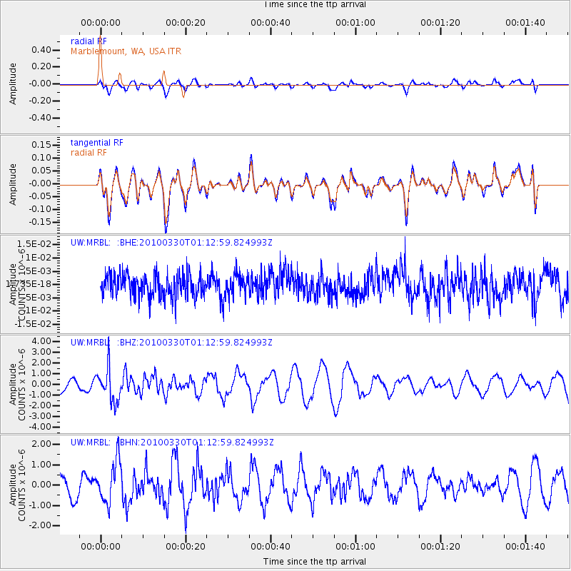
MRBL Marblemount, WA, USA - Earthquake Result Viewer
*The percent match for this event was below the threshold and hence no stack was calculated.
| Earthquake location: |
Eastern Sea Of Japan |
| Earthquake latitude/longitude: |
43.3/138.4 |
| Earthquake time(UTC): |
2010/03/30 (089) 01:02:53 GMT |
| Earthquake Depth: |
21 km |
| Earthquake Magnitude: |
6.1 MB, 5.3 MS, 5.7 MW, 5.6 MW |
| Earthquake Catalog/Contributor: |
WHDF/NEIC |
|
| Network: |
UW Pacific Northwest Regional Seismic Network |
| Station: |
MRBL Marblemount, WA, USA |
| Lat/Lon: |
48.52 N/121.48 W |
| Elevation: |
75 m |
|
| Distance: |
64.8 deg |
| Az: |
46.308 deg |
| Baz: |
307.443 deg |
| Ray Param: |
$rayparam |
*The percent match for this event was below the threshold and hence was not used in the summary stack. |
|
| Radial Match: |
32.227345 % |
| Radial Bump: |
400 |
| Transverse Match: |
32.195583 % |
| Transverse Bump: |
400 |
| SOD ConfigId: |
312771 |
| Insert Time: |
2010-06-28 18:01:19.191 +0000 |
| GWidth: |
2.5 |
| Max Bumps: |
400 |
| Tol: |
0.001 |
|
Signal To Noise
| Channel | StoN | STA | LTA |
| UW:MRBL: :BHZ:20100330T01:12:59.824993Z | 2.294599 | 1.5781658E-6 | 6.877741E-7 |
| UW:MRBL: :BHN:20100330T01:12:59.824993Z | 2.0713103 | 1.0522333E-6 | 5.0800367E-7 |
| UW:MRBL: :BHE:20100330T01:12:59.824993Z | 1.0036011 | 4.17413E-9 | 4.1591526E-9 |
| Arrivals |
| Ps | |
| PpPs | |
| PsPs/PpSs | |


