You are here: Home > Network List > UW - Pacific Northwest Regional Seismic Network Stations List
> Station UMAT Pilot Rock, OR, USA > Earthquake Result Viewer
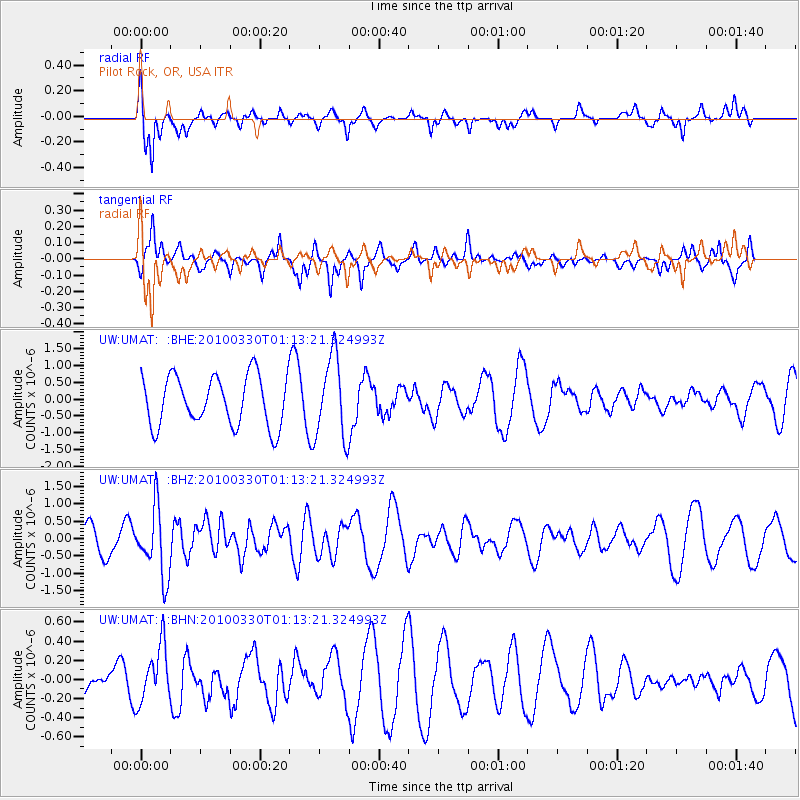
UMAT Pilot Rock, OR, USA - Earthquake Result Viewer
*The percent match for this event was below the threshold and hence no stack was calculated.
| Earthquake location: |
Eastern Sea Of Japan |
| Earthquake latitude/longitude: |
43.3/138.4 |
| Earthquake time(UTC): |
2010/03/30 (089) 01:02:53 GMT |
| Earthquake Depth: |
21 km |
| Earthquake Magnitude: |
6.1 MB, 5.3 MS, 5.7 MW, 5.6 MW |
| Earthquake Catalog/Contributor: |
WHDF/NEIC |
|
| Network: |
UW Pacific Northwest Regional Seismic Network |
| Station: |
UMAT Pilot Rock, OR, USA |
| Lat/Lon: |
45.29 N/118.96 W |
| Elevation: |
1318 m |
|
| Distance: |
68.2 deg |
| Az: |
47.876 deg |
| Baz: |
309.907 deg |
| Ray Param: |
$rayparam |
*The percent match for this event was below the threshold and hence was not used in the summary stack. |
|
| Radial Match: |
63.13047 % |
| Radial Bump: |
322 |
| Transverse Match: |
48.200317 % |
| Transverse Bump: |
265 |
| SOD ConfigId: |
312771 |
| Insert Time: |
2010-06-28 18:01:29.355 +0000 |
| GWidth: |
2.5 |
| Max Bumps: |
400 |
| Tol: |
0.001 |
|
Signal To Noise
| Channel | StoN | STA | LTA |
| UW:UMAT: :BHZ:20100330T01:13:21.324993Z | 1.9695612 | 9.783708E-7 | 4.967456E-7 |
| UW:UMAT: :BHN:20100330T01:13:21.324993Z | 2.4356623 | 2.9221556E-7 | 1.1997376E-7 |
| UW:UMAT: :BHE:20100330T01:13:21.324993Z | 1.6344607 | 1.2126877E-6 | 7.4194975E-7 |
| Arrivals |
| Ps | |
| PpPs | |
| PsPs/PpSs | |


