You are here: Home > Network List > UU - University of Utah Regional Network Stations List
> Station FORU South Mineral Mountains, UT, USA > Earthquake Result Viewer
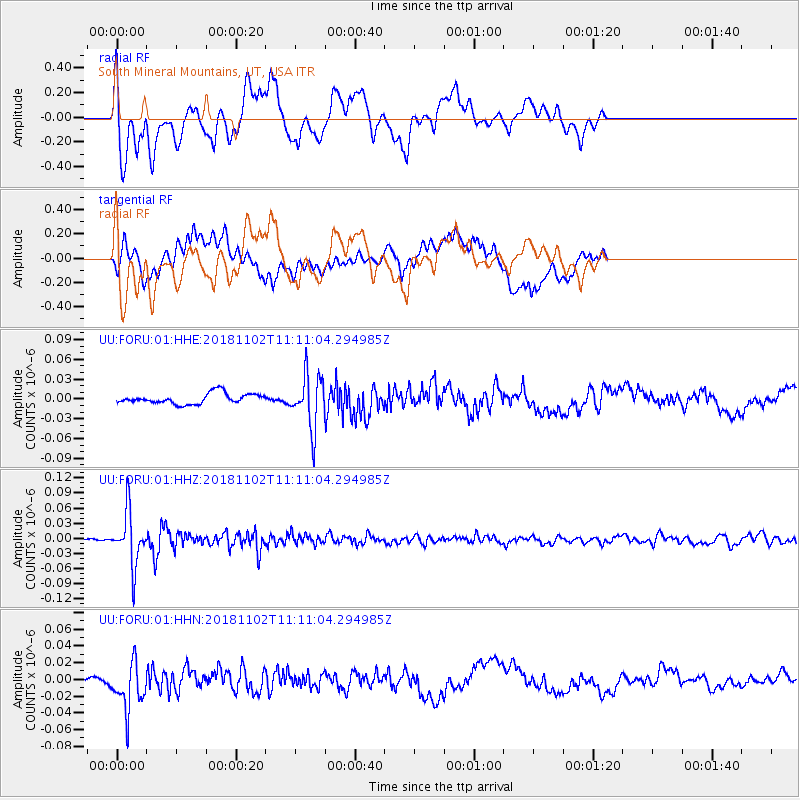
FORU South Mineral Mountains, UT, USA - Earthquake Result Viewer
*The percent match for this event was below the threshold and hence no stack was calculated.
| Earthquake location: |
Northwest Of Kuril Islands |
| Earthquake latitude/longitude: |
47.8/146.7 |
| Earthquake time(UTC): |
2018/11/02 (306) 11:01:15 GMT |
| Earthquake Depth: |
432 km |
| Earthquake Magnitude: |
5.9 Mww |
| Earthquake Catalog/Contributor: |
NEIC PDE/us |
|
| Network: |
UU University of Utah Regional Network |
| Station: |
FORU South Mineral Mountains, UT, USA |
| Lat/Lon: |
38.46 N/112.86 W |
| Elevation: |
1840 m |
|
| Distance: |
68.8 deg |
| Az: |
55.921 deg |
| Baz: |
314.679 deg |
| Ray Param: |
$rayparam |
*The percent match for this event was below the threshold and hence was not used in the summary stack. |
|
| Radial Match: |
64.845894 % |
| Radial Bump: |
400 |
| Transverse Match: |
55.86946 % |
| Transverse Bump: |
400 |
| SOD ConfigId: |
3131071 |
| Insert Time: |
2018-11-16 11:17:17.493 +0000 |
| GWidth: |
2.5 |
| Max Bumps: |
400 |
| Tol: |
0.001 |
|
Signal To Noise
| Channel | StoN | STA | LTA |
| UU:FORU:01:HHZ:20181102T11:11:04.294985Z | 20.431744 | 5.3360466E-8 | 2.6116453E-9 |
| UU:FORU:01:HHN:20181102T11:11:04.294985Z | 2.514246 | 2.974297E-8 | 1.1829778E-8 |
| UU:FORU:01:HHE:20181102T11:11:04.294985Z | 5.1186213 | 4.0086967E-8 | 7.831594E-9 |
| Arrivals |
| Ps | |
| PpPs | |
| PsPs/PpSs | |


