
BOSA Boshof, South Africa - Earthquake Result Viewer
| ||||||||||||||||||
| ||||||||||||||||||
| ||||||||||||||||||
|
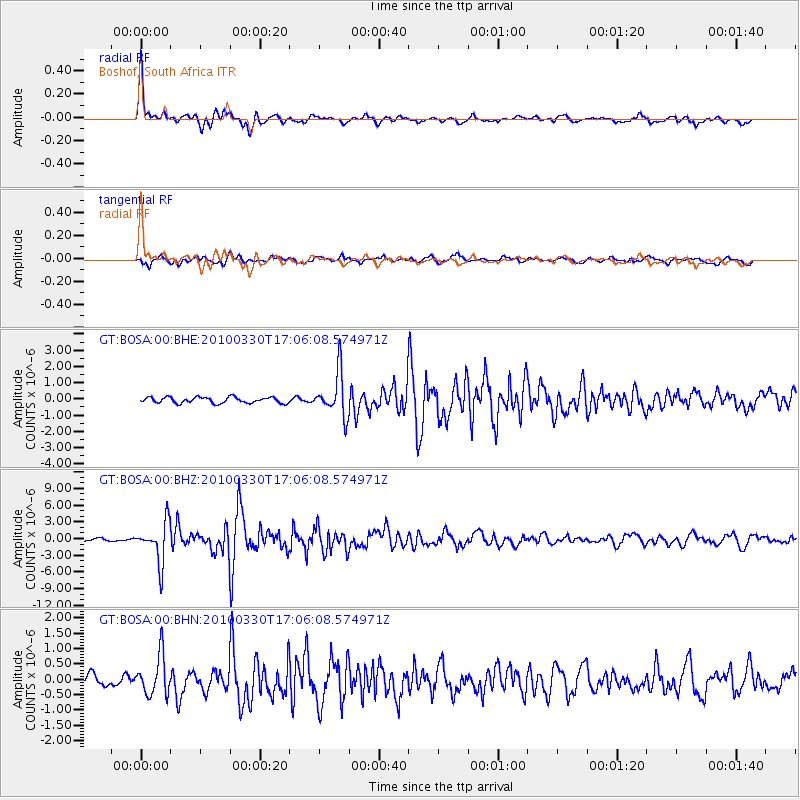
Signal To Noise
| Channel | StoN | STA | LTA |
| GT:BOSA:00:BHZ:20100330T17:06:08.574971Z | 13.354149 | 3.6099673E-6 | 2.703255E-7 |
| GT:BOSA:00:BHN:20100330T17:06:08.574971Z | 3.9800973 | 6.511366E-7 | 1.6359814E-7 |
| GT:BOSA:00:BHE:20100330T17:06:08.574971Z | 7.523129 | 1.3424831E-6 | 1.7844744E-7 |
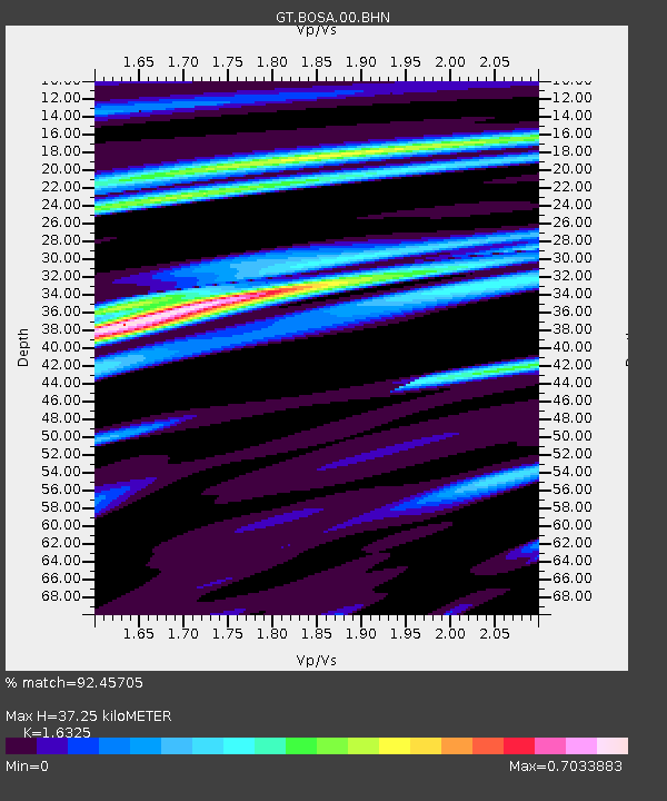
| Arrivals | |
| Ps | 3.8 SECOND |
| PpPs | 15 SECOND |
| PsPs/PpSs | 18 SECOND |

