You are here: Home > Network List > UU - University of Utah Regional Network Stations List
> Station KNB Kanab, UT, USA > Earthquake Result Viewer
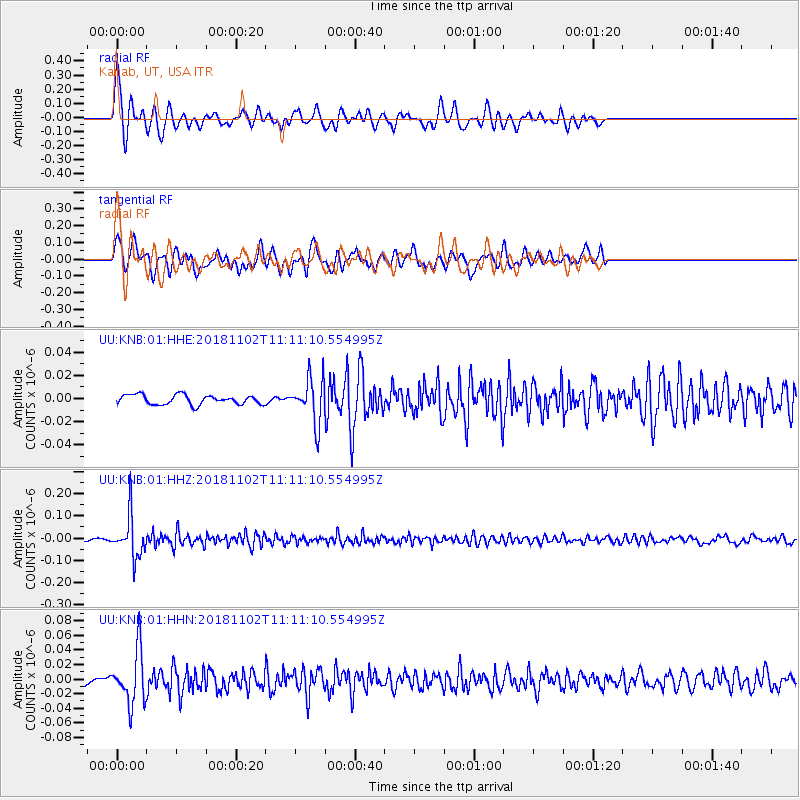
KNB Kanab, UT, USA - Earthquake Result Viewer
*The percent match for this event was below the threshold and hence no stack was calculated.
| Earthquake location: |
Northwest Of Kuril Islands |
| Earthquake latitude/longitude: |
47.8/146.7 |
| Earthquake time(UTC): |
2018/11/02 (306) 11:01:15 GMT |
| Earthquake Depth: |
432 km |
| Earthquake Magnitude: |
5.9 Mww |
| Earthquake Catalog/Contributor: |
NEIC PDE/us |
|
| Network: |
UU University of Utah Regional Network |
| Station: |
KNB Kanab, UT, USA |
| Lat/Lon: |
37.02 N/112.82 W |
| Elevation: |
1715 m |
|
| Distance: |
69.8 deg |
| Az: |
56.988 deg |
| Baz: |
315.081 deg |
| Ray Param: |
$rayparam |
*The percent match for this event was below the threshold and hence was not used in the summary stack. |
|
| Radial Match: |
78.62714 % |
| Radial Bump: |
400 |
| Transverse Match: |
63.47642 % |
| Transverse Bump: |
400 |
| SOD ConfigId: |
3131071 |
| Insert Time: |
2018-11-16 11:17:25.939 +0000 |
| GWidth: |
2.5 |
| Max Bumps: |
400 |
| Tol: |
0.001 |
|
Signal To Noise
| Channel | StoN | STA | LTA |
| UU:KNB:01:HHZ:20181102T11:11:10.554995Z | 21.475399 | 9.189052E-8 | 4.2788737E-9 |
| UU:KNB:01:HHN:20181102T11:11:10.554995Z | 6.0777307 | 3.6333656E-8 | 5.978162E-9 |
| UU:KNB:01:HHE:20181102T11:11:10.554995Z | 4.7129135 | 1.9288853E-8 | 4.092766E-9 |
| Arrivals |
| Ps | |
| PpPs | |
| PsPs/PpSs | |


