WRAB Tennant Creek, NT, Australia - Earthquake Result Viewer
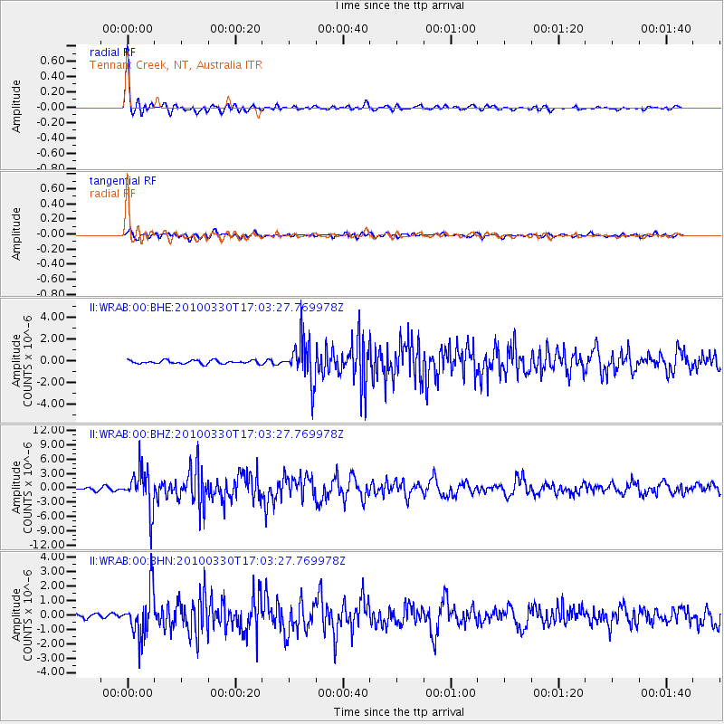
Earthquake location: Andaman Islands, India Region
Earthquake latitude/longitude: 13.7/92.8
Earthquake time(UTC): 2010/03/30 (089) 16:54:46 GMT
Earthquake Depth: 34 km
Earthquake Magnitude: 6.5 MB, 6.3 MS, 6.7 MW, 6.6 MW
Earthquake Catalog/Contributor: WHDF/NEIC
Network: II Global Seismograph Network (GSN - IRIS/IDA)
Station: WRAB Tennant Creek, NT, Australia
Lat/Lon: 19.93 S/134.36 E
Elevation: 366 m
Distance: 52.8 deg
Az: 128.423 deg
Baz: 305.958 deg
Ray Param: 0.06648374
Estimated Moho Depth: 15.75 km
Estimated Crust Vp/Vs: 1.79
Assumed Crust Vp: 6.642 km/s
Estimated Crust Vs: 3.721 km/s
Estimated Crust Poisson's Ratio: 0.27
Radial Match: 96.37375 %
Radial Bump: 369
Transverse Match: 77.9904 %
Transverse Bump: 400
SOD ConfigId: 312771
Insert Time: 2010-06-28 18:08:12.878 +0000
GWidth: 2.5
Max Bumps: 400
Tol: 0.001

Signal To Noise

ChannelStoNSTALTA
II:WRAB:00:BHZ:20100330T17:03:27.769978Z16.4290684.244487E-62.5835232E-7
II:WRAB:00:BHN:20100330T17:03:27.769978Z9.2168731.5962203E-61.7318457E-7
II:WRAB:00:BHE:20100330T17:03:27.769978Z12.5220051.9635274E-61.5680615E-7
Arrivals
Ps2.0 SECOND
PpPs6.2 SECOND
PsPs/PpSs8.2 SECOND