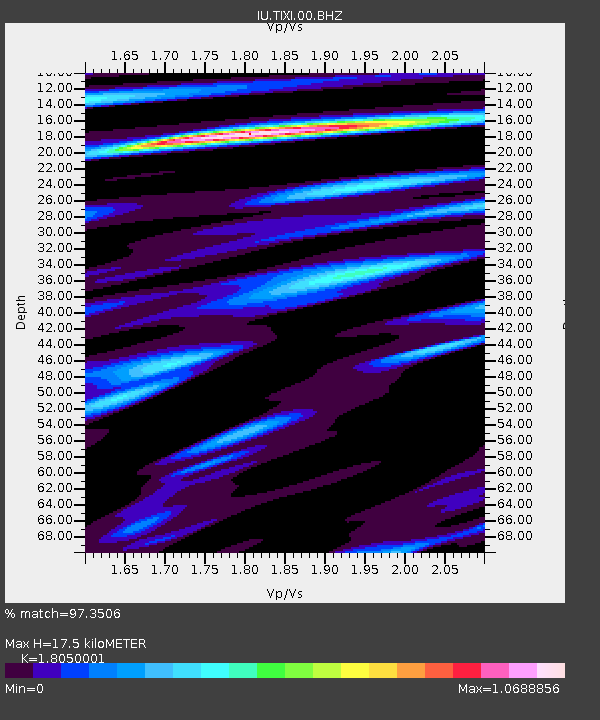
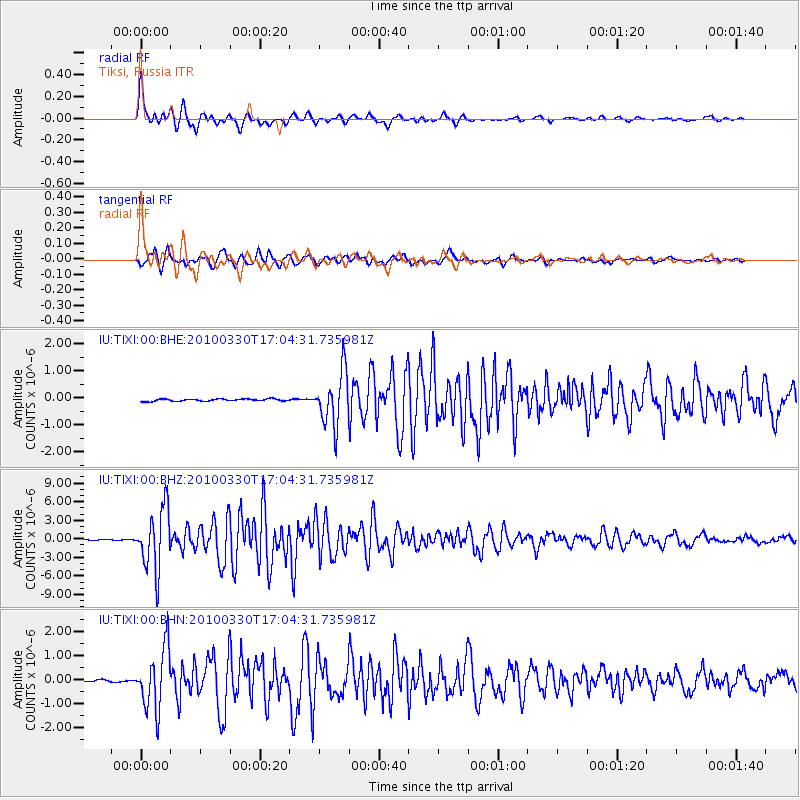
TIXI Tiksi, Russia - Earthquake Result Viewer

Earthquake location: Andaman Islands, India Region
Earthquake latitude/longitude: 13.7/92.8
Earthquake time(UTC): 2010/03/30 (089) 16:54:46 GMT
Earthquake Depth: 34 km
Earthquake Magnitude: 6.5 MB, 6.3 MS, 6.7 MW, 6.6 MW
Earthquake Catalog/Contributor: WHDF/NEIC
Network: IU Global Seismograph Network (GSN - IRIS/USGS)
Station: TIXI Tiksi, Russia
Lat/Lon: 71.63 N/128.87 E
Elevation: 40 m
Distance: 61.8 deg
Az: 12.211 deg
Baz: 220.435 deg
Ray Param: 0.06055888
Estimated Moho Depth: 17.5 km
Estimated Crust Vp/Vs: 1.81
Assumed Crust Vp: 6.552 km/s
Estimated Crust Vs: 3.63 km/s
Estimated Crust Poisson's Ratio: 0.28
Radial Match: 97.3506 %
Radial Bump: 400
Transverse Match: 94.50488 %
Transverse Bump: 400
SOD ConfigId: 312771
Insert Time: 2010-06-28 18:08:36.048 +0000
GWidth: 2.5
Max Bumps: 400
Tol: 0.001

Signal To Noise

ChannelStoNSTALTA
IU:TIXI:00:BHZ:20100330T17:04:31.735981Z90.403354.9742716E-65.502309E-8
IU:TIXI:00:BHN:20100330T17:04:31.735981Z35.7938421.2590915E-63.5176207E-8
IU:TIXI:00:BHE:20100330T17:04:31.735981Z24.2554049.905028E-74.083638E-8
Arrivals
Ps2.3 SECOND
PpPs7.2 SECOND
PsPs/PpSs9.4 SECOND