You are here: Home > Network List > WY - Yellowstone Wyoming Seismic Network Stations List
> Station YHH Holmes Hill, YNP, WY, USA > Earthquake Result Viewer
YHH Holmes Hill, YNP, WY, USA - Earthquake Result Viewer
*The percent match for this event was below the threshold and hence no stack was calculated.
| Earthquake location: |
Northwest Of Kuril Islands |
| Earthquake latitude/longitude: |
47.8/146.7 |
| Earthquake time(UTC): |
2018/11/02 (306) 11:01:15 GMT |
| Earthquake Depth: |
432 km |
| Earthquake Magnitude: |
5.9 Mww |
| Earthquake Catalog/Contributor: |
NEIC PDE/us |
|
| Network: |
WY Yellowstone Wyoming Seismic Network |
| Station: |
YHH Holmes Hill, YNP, WY, USA |
| Lat/Lon: |
44.79 N/110.85 W |
| Elevation: |
2717 m |
|
| Distance: |
65.5 deg |
| Az: |
49.858 deg |
| Baz: |
313.652 deg |
| Ray Param: |
$rayparam |
*The percent match for this event was below the threshold and hence was not used in the summary stack. |
|
| Radial Match: |
69.09353 % |
| Radial Bump: |
400 |
| Transverse Match: |
67.972885 % |
| Transverse Bump: |
400 |
| SOD ConfigId: |
3131071 |
| Insert Time: |
2018-11-16 11:18:13.420 +0000 |
| GWidth: |
2.5 |
| Max Bumps: |
400 |
| Tol: |
0.001 |
|
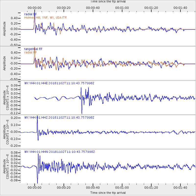
Signal To Noise
| Channel | StoN | STA | LTA |
| WY:YHH:01:HHZ:20181102T11:10:43.757998Z | 17.57463 | 6.0689025E-8 | 3.4532175E-9 |
| WY:YHH:01:HHN:20181102T11:10:43.757998Z | 9.984682 | 3.2209506E-8 | 3.2258918E-9 |
| WY:YHH:01:HHE:20181102T11:10:43.757998Z | 5.010845 | 3.5065323E-8 | 6.9978863E-9 |
| Arrivals |
| Ps | |
| PpPs | |
| PsPs/PpSs | |


