MDM Murphy Dome - Earthquake Result Viewer
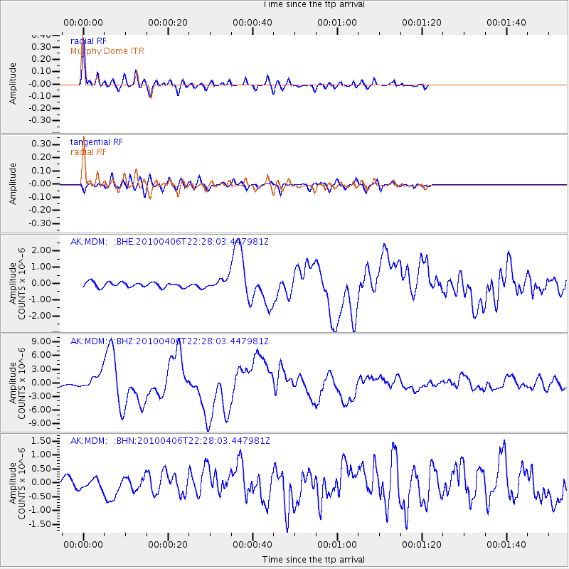
Earthquake location: Northern Sumatra, Indonesia
Earthquake latitude/longitude: 2.4/97.0
Earthquake time(UTC): 2010/04/06 (096) 22:15:01 GMT
Earthquake Depth: 31 km
Earthquake Magnitude: 7.0 MB, 7.9 MS, 7.8 MW, 7.7 MW
Earthquake Catalog/Contributor: WHDF/NEIC
Network: AK Alaska Regional Network
Station: MDM Murphy Dome
Lat/Lon: 64.96 N/148.23 W
Elevation: 634 m
Distance: 98.1 deg
Az: 22.984 deg
Baz: 293.558 deg
Ray Param: 0.040001266
Estimated Moho Depth: 31.0 km
Estimated Crust Vp/Vs: 1.72
Assumed Crust Vp: 6.566 km/s
Estimated Crust Vs: 3.829 km/s
Estimated Crust Poisson's Ratio: 0.24
Radial Match: 96.08183 %
Radial Bump: 400
Transverse Match: 86.039474 %
Transverse Bump: 400
SOD ConfigId: 314316
Insert Time: 2010-07-27 06:34:42.382 +0000
GWidth: 2.5
Max Bumps: 400
Tol: 0.001

Signal To Noise

ChannelStoNSTALTA
AK:MDM: :BHZ:20100406T22:28:03.447981Z10.0857731.7764002E-61.761293E-7
AK:MDM: :BHN:20100406T22:28:03.447981Z1.11464881.7262958E-71.5487352E-7
AK:MDM: :BHE:20100406T22:28:03.447981Z2.03294923.1697758E-71.5592006E-7
Arrivals
Ps3.4 SECOND
PpPs13 SECOND
PsPs/PpSs16 SECOND