You are here: Home > Network List > IU - Global Seismograph Network (GSN - IRIS/USGS) Stations List
> Station PMG Port Moresby, New Guinea > Earthquake Result Viewer
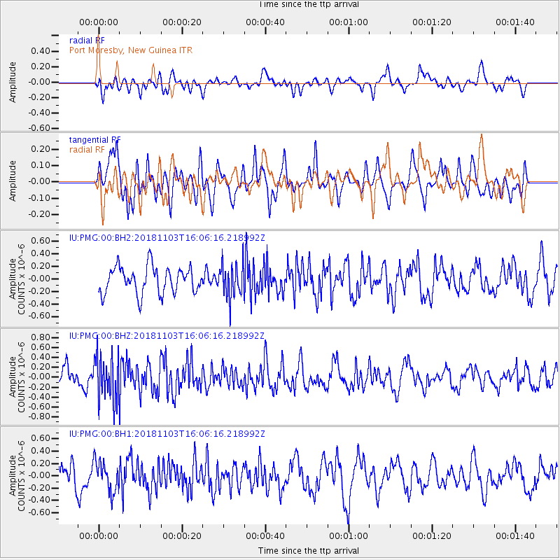
PMG Port Moresby, New Guinea - Earthquake Result Viewer
*The percent match for this event was below the threshold and hence no stack was calculated.
| Earthquake location: |
Southern Sumatra, Indonesia |
| Earthquake latitude/longitude: |
-3.8/101.8 |
| Earthquake time(UTC): |
2018/11/03 (307) 15:58:33 GMT |
| Earthquake Depth: |
51 km |
| Earthquake Magnitude: |
5.2 Mww |
| Earthquake Catalog/Contributor: |
NEIC PDE/us |
|
| Network: |
IU Global Seismograph Network (GSN - IRIS/USGS) |
| Station: |
PMG Port Moresby, New Guinea |
| Lat/Lon: |
9.40 S/147.16 E |
| Elevation: |
90 m |
|
| Distance: |
45.4 deg |
| Az: |
99.401 deg |
| Baz: |
273.924 deg |
| Ray Param: |
$rayparam |
*The percent match for this event was below the threshold and hence was not used in the summary stack. |
|
| Radial Match: |
51.46801 % |
| Radial Bump: |
400 |
| Transverse Match: |
68.16127 % |
| Transverse Bump: |
392 |
| SOD ConfigId: |
3131071 |
| Insert Time: |
2018-11-17 16:13:04.301 +0000 |
| GWidth: |
2.5 |
| Max Bumps: |
400 |
| Tol: |
0.001 |
|
Signal To Noise
| Channel | StoN | STA | LTA |
| IU:PMG:00:BHZ:20181103T16:06:16.218992Z | 2.6107996 | 4.4457136E-7 | 1.702817E-7 |
| IU:PMG:00:BH1:20181103T16:06:16.218992Z | 0.94798774 | 2.3736932E-7 | 2.5039282E-7 |
| IU:PMG:00:BH2:20181103T16:06:16.218992Z | 1.2787039 | 2.6984026E-7 | 2.1102638E-7 |
| Arrivals |
| Ps | |
| PpPs | |
| PsPs/PpSs | |


