
BJT Baijiatuan, Beijing, China - Earthquake Result Viewer
| ||||||||||||||||||
| ||||||||||||||||||
| ||||||||||||||||||
|
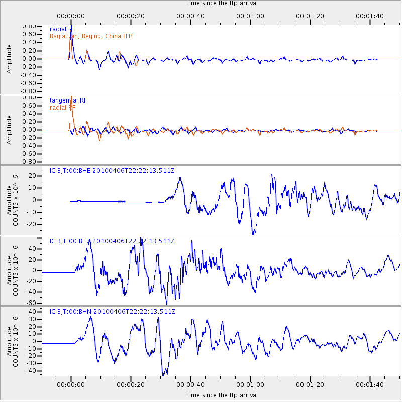
Signal To Noise
| Channel | StoN | STA | LTA |
| IC:BJT:00:BHZ:20100406T22:22:13.511Z | 19.570358 | 9.416764E-6 | 4.811749E-7 |
| IC:BJT:00:BHN:20100406T22:22:13.511Z | 15.364314 | 4.649582E-6 | 3.0262217E-7 |
| IC:BJT:00:BHE:20100406T22:22:13.511Z | 11.598348 | 2.3450548E-6 | 2.021887E-7 |
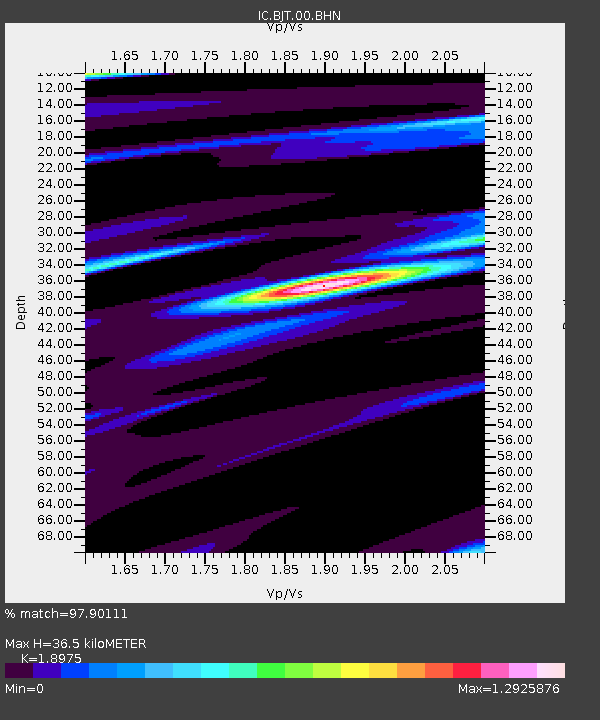
| Arrivals | |
| Ps | 5.4 SECOND |
| PpPs | 15 SECOND |
| PsPs/PpSs | 21 SECOND |

