AAK Ala Archa, Kyrgyzstan - Earthquake Result Viewer
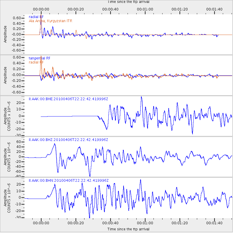
Earthquake location: Northern Sumatra, Indonesia
Earthquake latitude/longitude: 2.4/97.0
Earthquake time(UTC): 2010/04/06 (096) 22:15:01 GMT
Earthquake Depth: 31 km
Earthquake Magnitude: 7.0 MB, 7.9 MS, 7.8 MW, 7.7 MW
Earthquake Catalog/Contributor: WHDF/NEIC
Network: II Global Seismograph Network (GSN - IRIS/IDA)
Station: AAK Ala Archa, Kyrgyzstan
Lat/Lon: 42.64 N/74.49 E
Elevation: 1645 m
Distance: 44.9 deg
Az: 336.347 deg
Baz: 147.096 deg
Ray Param: 0.071593694
Estimated Moho Depth: 38.5 km
Estimated Crust Vp/Vs: 2.06
Assumed Crust Vp: 6.306 km/s
Estimated Crust Vs: 3.065 km/s
Estimated Crust Poisson's Ratio: 0.35
Radial Match: 95.808685 %
Radial Bump: 400
Transverse Match: 90.80373 %
Transverse Bump: 400
SOD ConfigId: 314316
Insert Time: 2010-07-27 06:37:54.498 +0000
GWidth: 2.5
Max Bumps: 400
Tol: 0.001

Signal To Noise

ChannelStoNSTALTA
II:AAK:00:BHZ:20100406T22:22:42.419996Z13.6251755.7700486E-64.2348432E-7
II:AAK:00:BHN:20100406T22:22:42.419996Z5.7978241.6444957E-62.8364013E-7
II:AAK:00:BHE:20100406T22:22:42.419996Z7.4122981.7896648E-62.4144532E-7
Arrivals
Ps6.8 SECOND
PpPs18 SECOND
PsPs/PpSs25 SECOND