WRAB Tennant Creek, NT, Australia - Earthquake Result Viewer
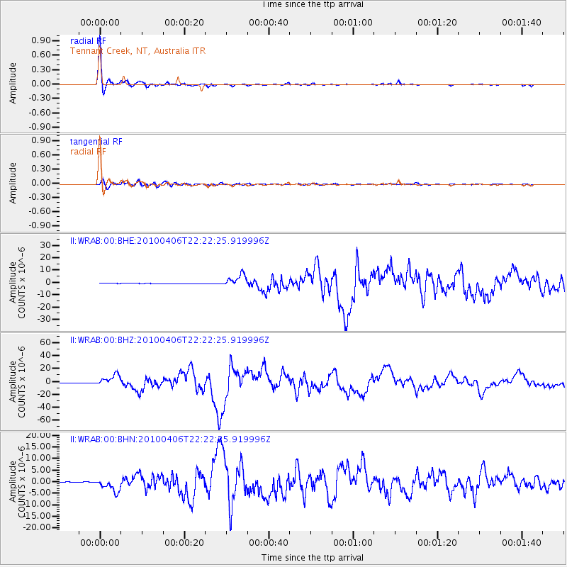
Earthquake location: Northern Sumatra, Indonesia
Earthquake latitude/longitude: 2.4/97.0
Earthquake time(UTC): 2010/04/06 (096) 22:15:01 GMT
Earthquake Depth: 31 km
Earthquake Magnitude: 7.0 MB, 7.9 MS, 7.8 MW, 7.7 MW
Earthquake Catalog/Contributor: WHDF/NEIC
Network: II Global Seismograph Network (GSN - IRIS/IDA)
Station: WRAB Tennant Creek, NT, Australia
Lat/Lon: 19.93 S/134.36 E
Elevation: 366 m
Distance: 42.8 deg
Az: 122.942 deg
Baz: 296.969 deg
Ray Param: 0.07289296
Estimated Moho Depth: 14.75 km
Estimated Crust Vp/Vs: 1.87
Assumed Crust Vp: 6.642 km/s
Estimated Crust Vs: 3.557 km/s
Estimated Crust Poisson's Ratio: 0.30
Radial Match: 99.04173 %
Radial Bump: 234
Transverse Match: 91.78065 %
Transverse Bump: 400
SOD ConfigId: 314316
Insert Time: 2010-07-27 06:38:01.652 +0000
GWidth: 2.5
Max Bumps: 400
Tol: 0.001

Signal To Noise

ChannelStoNSTALTA
II:WRAB:00:BHZ:20100406T22:22:25.919996Z40.859128.651104E-62.1173005E-7
II:WRAB:00:BHN:20100406T22:22:25.919996Z24.0921342.8669767E-61.1900053E-7
II:WRAB:00:BHE:20100406T22:22:25.919996Z38.1275635.0032163E-61.3122308E-7
Arrivals
Ps2.1 SECOND
PpPs5.9 SECOND
PsPs/PpSs8.0 SECOND