ARU Arti, Russia - Earthquake Result Viewer
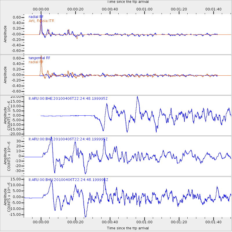
Earthquake location: Northern Sumatra, Indonesia
Earthquake latitude/longitude: 2.4/97.0
Earthquake time(UTC): 2010/04/06 (096) 22:15:01 GMT
Earthquake Depth: 31 km
Earthquake Magnitude: 7.0 MB, 7.9 MS, 7.8 MW, 7.7 MW
Earthquake Catalog/Contributor: WHDF/NEIC
Network: II Global Seismograph Network (GSN - IRIS/IDA)
Station: ARU Arti, Russia
Lat/Lon: 56.43 N/58.56 E
Elevation: 260 m
Distance: 62.0 deg
Az: 336.957 deg
Baz: 135.255 deg
Ray Param: 0.06043789
Estimated Moho Depth: 39.0 km
Estimated Crust Vp/Vs: 1.60
Assumed Crust Vp: 6.159 km/s
Estimated Crust Vs: 3.849 km/s
Estimated Crust Poisson's Ratio: 0.18
Radial Match: 97.35892 %
Radial Bump: 300
Transverse Match: 85.25026 %
Transverse Bump: 400
SOD ConfigId: 314316
Insert Time: 2010-07-27 06:38:08.208 +0000
GWidth: 2.5
Max Bumps: 400
Tol: 0.001

Signal To Noise

ChannelStoNSTALTA
II:ARU:00:BHZ:20100406T22:24:48.199995Z31.5399939.399278E-62.9801143E-7
II:ARU:00:BHN:20100406T22:24:48.199995Z15.707972.9056644E-61.8498027E-7
II:ARU:00:BHE:20100406T22:24:48.199995Z16.8017863.1899858E-61.8985992E-7
Arrivals
Ps4.0 SECOND
PpPs16 SECOND
PsPs/PpSs20 SECOND