
KBL Kabul, Afghanistan - Earthquake Result Viewer
| ||||||||||||||||||
| ||||||||||||||||||
| ||||||||||||||||||
|
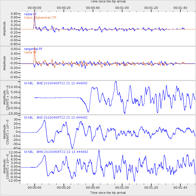
Signal To Noise
| Channel | StoN | STA | LTA |
| IU:KBL: :BHZ:20100406T22:22:13.44499Z | 59.845787 | 6.2993154E-6 | 1.0525913E-7 |
| IU:KBL: :BHN:20100406T22:22:13.44499Z | 34.50901 | 2.1275039E-6 | 6.1650674E-8 |
| IU:KBL: :BHE:20100406T22:22:13.44499Z | 44.66071 | 2.6236355E-6 | 5.8745943E-8 |
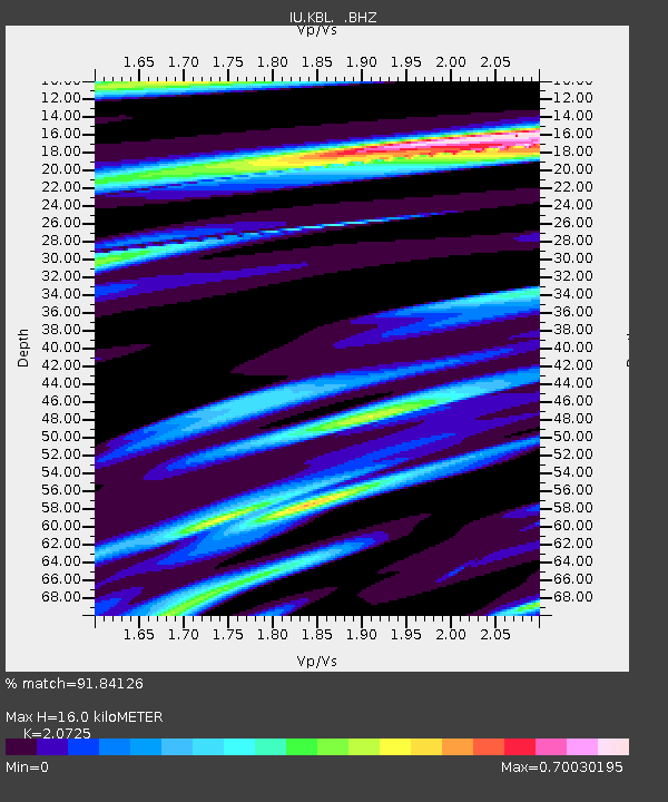
| Arrivals | |
| Ps | 2.8 SECOND |
| PpPs | 7.0 SECOND |
| PsPs/PpSs | 9.7 SECOND |

