BILL Bilibino, Russia - Earthquake Result Viewer
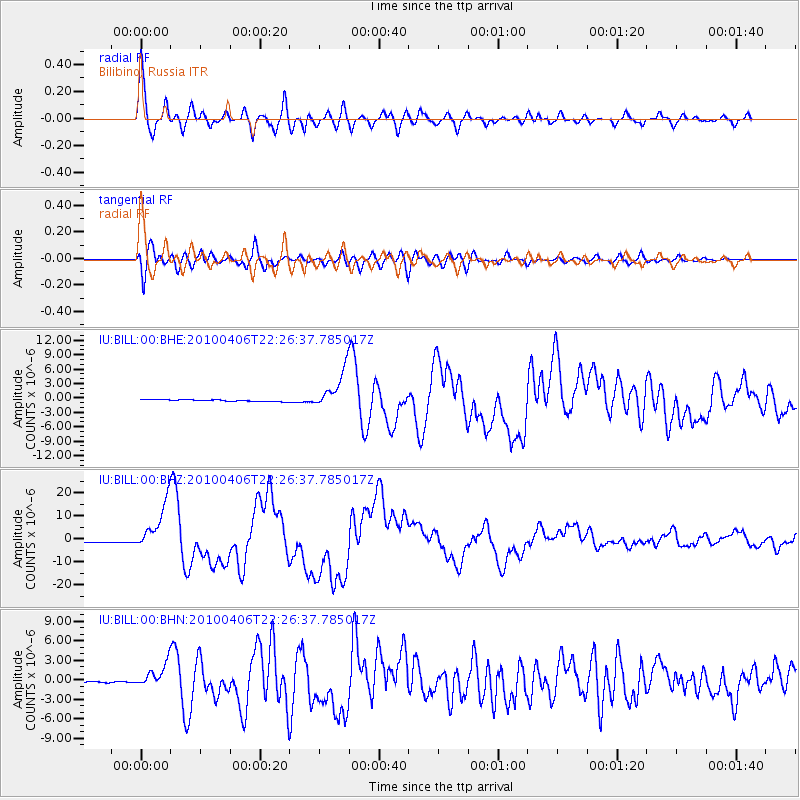
Earthquake location: Northern Sumatra, Indonesia
Earthquake latitude/longitude: 2.4/97.0
Earthquake time(UTC): 2010/04/06 (096) 22:15:01 GMT
Earthquake Depth: 31 km
Earthquake Magnitude: 7.0 MB, 7.9 MS, 7.8 MW, 7.7 MW
Earthquake Catalog/Contributor: WHDF/NEIC
Network: IU Global Seismograph Network (GSN - IRIS/USGS)
Station: BILL Bilibino, Russia
Lat/Lon: 68.07 N/166.45 E
Elevation: 320 m
Distance: 80.2 deg
Az: 20.911 deg
Baz: 251.652 deg
Ray Param: 0.048402954
Estimated Moho Depth: 54.0 km
Estimated Crust Vp/Vs: 2.03
Assumed Crust Vp: 6.577 km/s
Estimated Crust Vs: 3.248 km/s
Estimated Crust Poisson's Ratio: 0.34
Radial Match: 97.2732 %
Radial Bump: 400
Transverse Match: 91.83348 %
Transverse Bump: 400
SOD ConfigId: 314316
Insert Time: 2010-07-27 06:38:27.626 +0000
GWidth: 2.5
Max Bumps: 400
Tol: 0.001

Signal To Noise

ChannelStoNSTALTA
IU:BILL:00:BHZ:20100406T22:26:37.785017Z32.612651.0779794E-53.3054025E-7
IU:BILL:00:BHN:20100406T22:26:37.785017Z19.4574951.8809557E-69.6669986E-8
IU:BILL:00:BHE:20100406T22:26:37.785017Z23.6734054.0020436E-61.690523E-7
Arrivals
Ps8.6 SECOND
PpPs24 SECOND
PsPs/PpSs33 SECOND