ANTO Ankara, Turkey - Earthquake Result Viewer
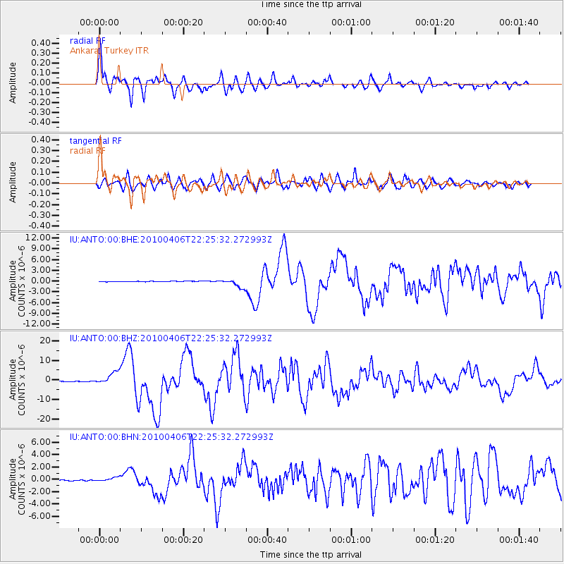
Earthquake location: Northern Sumatra, Indonesia
Earthquake latitude/longitude: 2.4/97.0
Earthquake time(UTC): 2010/04/06 (096) 22:15:01 GMT
Earthquake Depth: 31 km
Earthquake Magnitude: 7.0 MB, 7.9 MS, 7.8 MW, 7.7 MW
Earthquake Catalog/Contributor: WHDF/NEIC
Network: IU Global Seismograph Network (GSN - IRIS/USGS)
Station: ANTO Ankara, Turkey
Lat/Lon: 39.87 N/32.79 E
Elevation: 1090 m
Distance: 68.9 deg
Az: 311.997 deg
Baz: 105.247 deg
Ray Param: 0.05597174
Estimated Moho Depth: 15.25 km
Estimated Crust Vp/Vs: 1.60
Assumed Crust Vp: 6.159 km/s
Estimated Crust Vs: 3.843 km/s
Estimated Crust Poisson's Ratio: 0.18
Radial Match: 93.96079 %
Radial Bump: 400
Transverse Match: 87.000946 %
Transverse Bump: 400
SOD ConfigId: 314316
Insert Time: 2010-07-27 06:38:32.414 +0000
GWidth: 2.5
Max Bumps: 400
Tol: 0.001

Signal To Noise

ChannelStoNSTALTA
IU:ANTO:00:BHZ:20100406T22:25:32.272993Z23.4699543.3116646E-61.411023E-7
IU:ANTO:00:BHN:20100406T22:25:32.272993Z4.8820223.4799842E-77.128162E-8
IU:ANTO:00:BHE:20100406T22:25:32.272993Z13.2177841.2569709E-69.509695E-8
Arrivals
Ps1.6 SECOND
PpPs6.2 SECOND
PsPs/PpSs7.8 SECOND