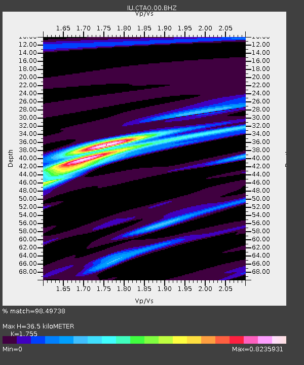
CTAO Charters Towers, Australia - Earthquake Result Viewer
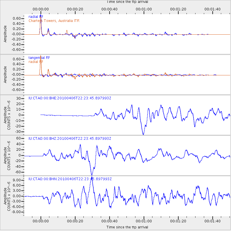
Earthquake location: Northern Sumatra, Indonesia
Earthquake latitude/longitude: 2.4/97.0
Earthquake time(UTC): 2010/04/06 (096) 22:15:01 GMT
Earthquake Depth: 31 km
Earthquake Magnitude: 7.0 MB, 7.9 MS, 7.8 MW, 7.7 MW
Earthquake Catalog/Contributor: WHDF/NEIC
Network: IU Global Seismograph Network (GSN - IRIS/USGS)
Station: CTAO Charters Towers, Australia
Lat/Lon: 20.09 S/146.25 E
Elevation: 357 m
Distance: 53.2 deg
Az: 117.251 deg
Baz: 289.084 deg
Ray Param: 0.06622278
Estimated Moho Depth: 36.5 km
Estimated Crust Vp/Vs: 1.75
Assumed Crust Vp: 6.522 km/s
Estimated Crust Vs: 3.716 km/s
Estimated Crust Poisson's Ratio: 0.26
Radial Match: 98.49738 %
Radial Bump: 216
Transverse Match: 96.22173 %
Transverse Bump: 400
SOD ConfigId: 314316
Insert Time: 2010-07-27 06:38:33.219 +0000
GWidth: 2.5
Max Bumps: 400
Tol: 0.001

Signal To Noise

ChannelStoNSTALTA
IU:CTAO:00:BHZ:20100406T22:23:45.897993Z21.4614226.611686E-63.0807306E-7
IU:CTAO:00:BHN:20100406T22:23:45.897993Z10.1970391.1481417E-61.125956E-7
IU:CTAO:00:BHE:20100406T22:23:45.897993Z6.03919173.2161734E-65.325503E-7
Arrivals
Ps4.5 SECOND
PpPs15 SECOND
PsPs/PpSs19 SECOND