CASY Casey, Antarctica - Earthquake Result Viewer
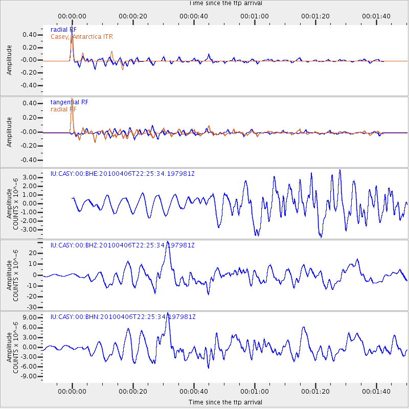
Earthquake location: Northern Sumatra, Indonesia
Earthquake latitude/longitude: 2.4/97.0
Earthquake time(UTC): 2010/04/06 (096) 22:15:01 GMT
Earthquake Depth: 31 km
Earthquake Magnitude: 7.0 MB, 7.9 MS, 7.8 MW, 7.7 MW
Earthquake Catalog/Contributor: WHDF/NEIC
Network: IU Global Seismograph Network (GSN - IRIS/USGS)
Station: CASY Casey, Antarctica
Lat/Lon: 66.28 S/110.54 E
Elevation: 10 m
Distance: 69.2 deg
Az: 174.207 deg
Baz: 345.564 deg
Ray Param: 0.05576634
Estimated Moho Depth: 21.25 km
Estimated Crust Vp/Vs: 2.08
Assumed Crust Vp: 6.356 km/s
Estimated Crust Vs: 3.056 km/s
Estimated Crust Poisson's Ratio: 0.35
Radial Match: 96.186356 %
Radial Bump: 360
Transverse Match: 79.371605 %
Transverse Bump: 400
SOD ConfigId: 314316
Insert Time: 2010-07-27 06:38:36.747 +0000
GWidth: 2.5
Max Bumps: 400
Tol: 0.001

Signal To Noise

ChannelStoNSTALTA
IU:CASY:00:BHZ:20100406T22:25:34.197981Z1.63485661.381938E-68.4529614E-7
IU:CASY:00:BHN:20100406T22:25:34.197981Z0.48416162.6480328E-75.469316E-7
IU:CASY:00:BHE:20100406T22:25:34.197981Z1.3428588.2456756E-76.140393E-7
Arrivals
Ps3.7 SECOND
PpPs10.0 SECOND
PsPs/PpSs14 SECOND