You are here: Home > Network List > IW - Intermountain West Stations List
> Station MOOW Moose Ponds, Wyoming, USA > Earthquake Result Viewer
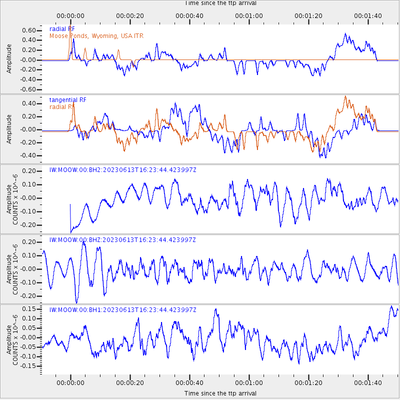
MOOW Moose Ponds, Wyoming, USA - Earthquake Result Viewer
*The percent match for this event was below the threshold and hence no stack was calculated.
| Earthquake location: |
Andreanof Islands, Aleutian Is. |
| Earthquake latitude/longitude: |
51.4/-178.4 |
| Earthquake time(UTC): |
2023/06/13 (164) 16:16:02 GMT |
| Earthquake Depth: |
16 km |
| Earthquake Magnitude: |
5.3 Mww |
| Earthquake Catalog/Contributor: |
NEIC PDE/us |
|
| Network: |
IW Intermountain West |
| Station: |
MOOW Moose Ponds, Wyoming, USA |
| Lat/Lon: |
43.75 N/110.74 W |
| Elevation: |
2128 m |
|
| Distance: |
44.8 deg |
| Az: |
72.085 deg |
| Baz: |
304.741 deg |
| Ray Param: |
$rayparam |
*The percent match for this event was below the threshold and hence was not used in the summary stack. |
|
| Radial Match: |
21.067493 % |
| Radial Bump: |
400 |
| Transverse Match: |
24.236473 % |
| Transverse Bump: |
400 |
| SOD ConfigId: |
30536071 |
| Insert Time: |
2023-06-27 16:27:36.079 +0000 |
| GWidth: |
2.5 |
| Max Bumps: |
400 |
| Tol: |
0.001 |
|
Signal To Noise
| Channel | StoN | STA | LTA |
| IW:MOOW:00:BHZ:20230613T16:23:44.423997Z | 2.262883 | 1.3891236E-7 | 6.138734E-8 |
| IW:MOOW:00:BH1:20230613T16:23:44.423997Z | 0.8914726 | 9.493451E-8 | 1.0649178E-7 |
| IW:MOOW:00:BH2:20230613T16:23:44.423997Z | 1.1629096 | 1.12446095E-7 | 9.669375E-8 |
| Arrivals |
| Ps | |
| PpPs | |
| PsPs/PpSs | |


