
USP KN.USP - Earthquake Result Viewer
| ||||||||||||||||||
| ||||||||||||||||||
| ||||||||||||||||||
|
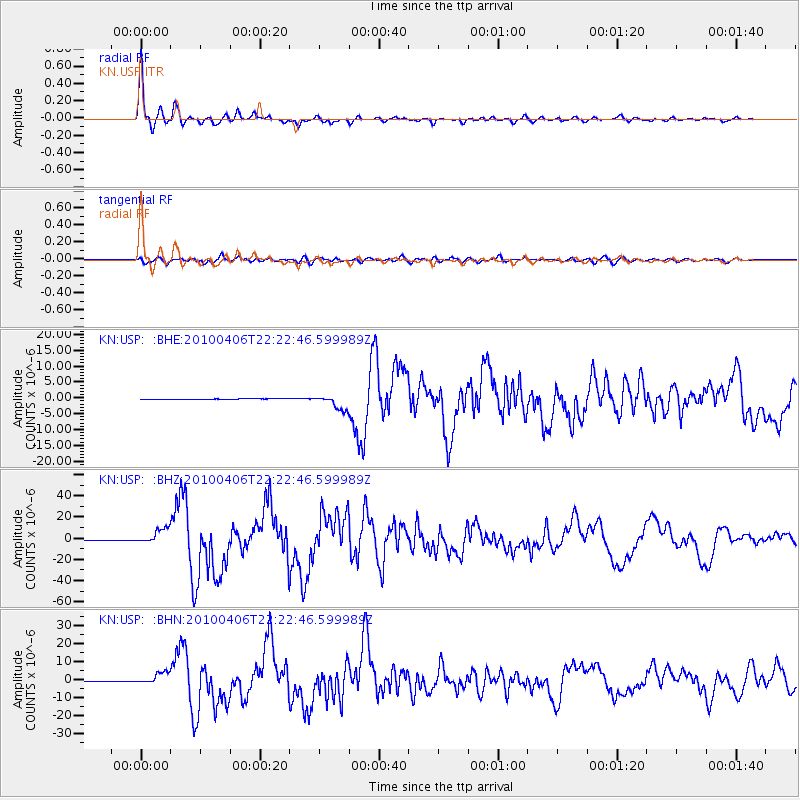
Signal To Noise
| Channel | StoN | STA | LTA |
| KN:USP: :BHZ:20100406T22:22:46.599989Z | 28.113636 | 7.4095165E-6 | 2.6355596E-7 |
| KN:USP: :BHN:20100406T22:22:46.599989Z | 26.452396 | 3.3513709E-6 | 1.2669442E-7 |
| KN:USP: :BHE:20100406T22:22:46.599989Z | 19.23144 | 2.3050197E-6 | 1.1985684E-7 |
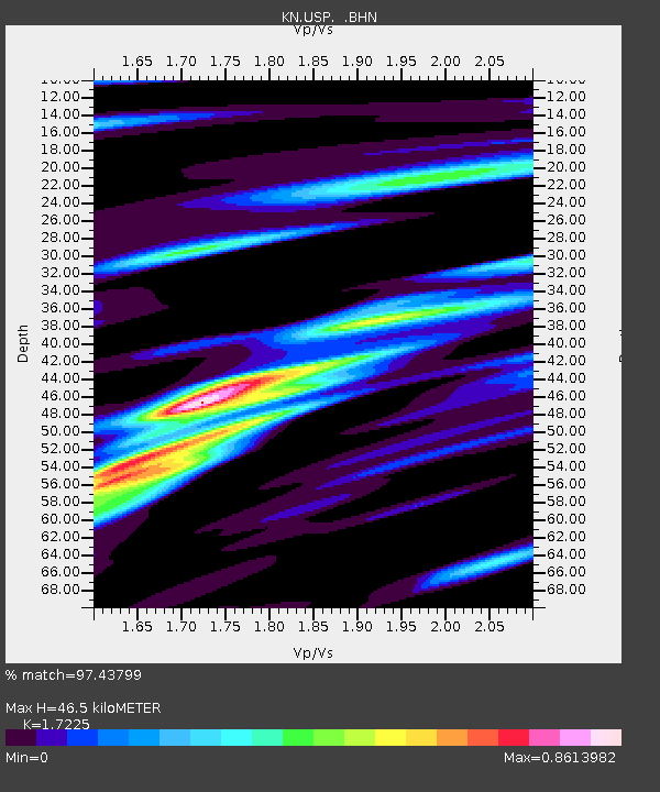
| Arrivals | |
| Ps | 5.7 SECOND |
| PpPs | 19 SECOND |
| PsPs/PpSs | 25 SECOND |

