KBK KN.KBK - Earthquake Result Viewer
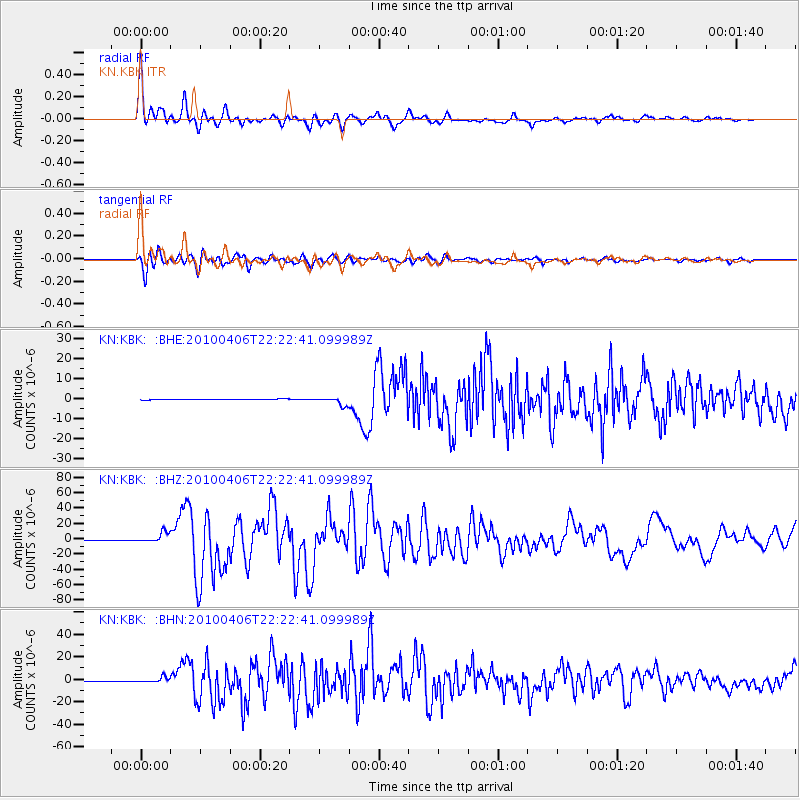
Earthquake location: Northern Sumatra, Indonesia
Earthquake latitude/longitude: 2.4/97.0
Earthquake time(UTC): 2010/04/06 (096) 22:15:01 GMT
Earthquake Depth: 31 km
Earthquake Magnitude: 7.0 MB, 7.9 MS, 7.8 MW, 7.7 MW
Earthquake Catalog/Contributor: WHDF/NEIC
Network: KN Kyrgyz Seismic Telemetry Network
Station: KBK KN.KBK
Lat/Lon: 42.66 N/74.95 E
Elevation: 1760 m
Distance: 44.7 deg
Az: 336.761 deg
Baz: 147.696 deg
Ray Param: 0.07169722
Estimated Moho Depth: 16.75 km
Estimated Crust Vp/Vs: 1.92
Assumed Crust Vp: 6.306 km/s
Estimated Crust Vs: 3.284 km/s
Estimated Crust Poisson's Ratio: 0.31
Radial Match: 92.52423 %
Radial Bump: 400
Transverse Match: 92.015045 %
Transverse Bump: 400
SOD ConfigId: 314316
Insert Time: 2010-07-27 06:39:29.906 +0000
GWidth: 2.5
Max Bumps: 400
Tol: 0.001

Signal To Noise

ChannelStoNSTALTA
KN:KBK: :BHZ:20100406T22:22:41.099989Z36.2920276.720741E-61.8518507E-7
KN:KBK: :BHN:20100406T22:22:41.099989Z12.7402292.3537725E-61.847512E-7
KN:KBK: :BHE:20100406T22:22:41.099989Z12.4052542.0519324E-61.6540832E-7
Arrivals
Ps2.6 SECOND
PpPs7.3 SECOND
PsPs/PpSs9.9 SECOND