
TRI Trieste, Italy - Earthquake Result Viewer
| ||||||||||||||||||
| ||||||||||||||||||
| ||||||||||||||||||
|
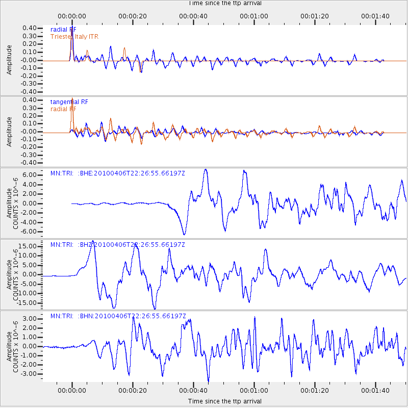
Signal To Noise
| Channel | StoN | STA | LTA |
| MN:TRI: :BHZ:20100406T22:26:55.66197Z | 18.690102 | 3.0814758E-6 | 1.6487208E-7 |
| MN:TRI: :BHN:20100406T22:26:55.66197Z | 1.3028644 | 1.4190125E-7 | 1.08914826E-7 |
| MN:TRI: :BHE:20100406T22:26:55.66197Z | 7.578965 | 9.580052E-7 | 1.2640317E-7 |
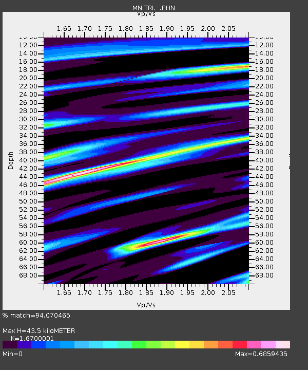
| Arrivals | |
| Ps | 4.8 SECOND |
| PpPs | 18 SECOND |
| PsPs/PpSs | 23 SECOND |

