You are here: Home > Network List > US - United States National Seismic Network Stations List
> Station EGMT Eagleton, Montana, USA > Earthquake Result Viewer
EGMT Eagleton, Montana, USA - Earthquake Result Viewer
*The percent match for this event was below the threshold and hence no stack was calculated.
| Earthquake location: |
Andreanof Islands, Aleutian Is. |
| Earthquake latitude/longitude: |
51.4/-178.4 |
| Earthquake time(UTC): |
2023/06/13 (164) 16:16:02 GMT |
| Earthquake Depth: |
16 km |
| Earthquake Magnitude: |
5.3 Mww |
| Earthquake Catalog/Contributor: |
NEIC PDE/us |
|
| Network: |
US United States National Seismic Network |
| Station: |
EGMT Eagleton, Montana, USA |
| Lat/Lon: |
48.02 N/109.75 W |
| Elevation: |
1055 m |
|
| Distance: |
43.0 deg |
| Az: |
66.373 deg |
| Baz: |
301.334 deg |
| Ray Param: |
$rayparam |
*The percent match for this event was below the threshold and hence was not used in the summary stack. |
|
| Radial Match: |
42.750973 % |
| Radial Bump: |
400 |
| Transverse Match: |
57.495384 % |
| Transverse Bump: |
400 |
| SOD ConfigId: |
30536071 |
| Insert Time: |
2023-06-27 16:39:50.615 +0000 |
| GWidth: |
2.5 |
| Max Bumps: |
400 |
| Tol: |
0.001 |
|
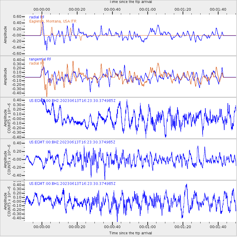
Signal To Noise
| Channel | StoN | STA | LTA |
| US:EGMT:00:BHZ:20230613T16:23:30.374985Z | 2.5265794 | 1.2783605E-7 | 5.059649E-8 |
| US:EGMT:00:BH1:20230613T16:23:30.374985Z | 1.3903012 | 1.6347538E-7 | 1.17582694E-7 |
| US:EGMT:00:BH2:20230613T16:23:30.374985Z | 0.98259896 | 1.5306338E-7 | 1.55774E-7 |
| Arrivals |
| Ps | |
| PpPs | |
| PsPs/PpSs | |


