You are here: Home > Network List > G - GEOSCOPE Stations List
> Station INU Inuyama, Japan > Earthquake Result Viewer
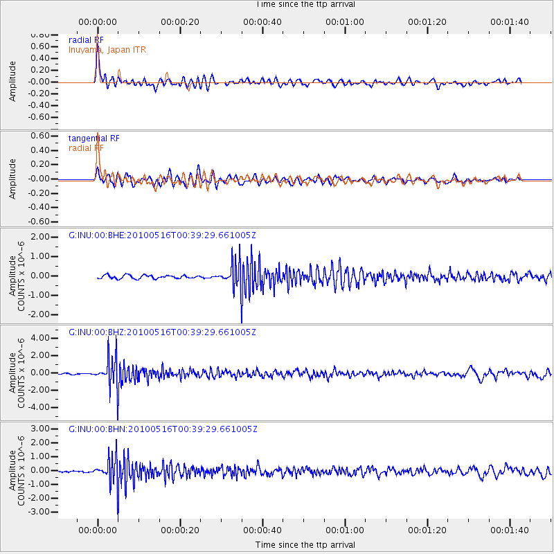
INU Inuyama, Japan - Earthquake Result Viewer
*The percent match for this event was below the threshold and hence no stack was calculated.
| Earthquake location: |
Minahassa Peninsula, Sulawesi |
| Earthquake latitude/longitude: |
0.5/124.7 |
| Earthquake time(UTC): |
2010/05/16 (136) 00:33:06 GMT |
| Earthquake Depth: |
123 km |
| Earthquake Magnitude: |
5.7 MB, 5.8 MW, 5.8 MW |
| Earthquake Catalog/Contributor: |
WHDF/NEIC |
|
| Network: |
G GEOSCOPE |
| Station: |
INU Inuyama, Japan |
| Lat/Lon: |
35.35 N/137.03 E |
| Elevation: |
132 m |
|
| Distance: |
36.5 deg |
| Az: |
17.112 deg |
| Baz: |
201.096 deg |
| Ray Param: |
$rayparam |
*The percent match for this event was below the threshold and hence was not used in the summary stack. |
|
| Radial Match: |
78.49815 % |
| Radial Bump: |
400 |
| Transverse Match: |
74.33538 % |
| Transverse Bump: |
400 |
| SOD ConfigId: |
314592 |
| Insert Time: |
2010-09-04 06:33:48.880 +0000 |
| GWidth: |
2.5 |
| Max Bumps: |
400 |
| Tol: |
0.001 |
|
Signal To Noise
| Channel | StoN | STA | LTA |
| G:INU:00:BHZ:20100516T00:39:29.661005Z | 19.351254 | 1.6951469E-6 | 8.759882E-8 |
| G:INU:00:BHN:20100516T00:39:29.661005Z | 21.256927 | 8.497169E-7 | 3.9973646E-8 |
| G:INU:00:BHE:20100516T00:39:29.661005Z | 7.0368557 | 6.108876E-7 | 8.681258E-8 |
| Arrivals |
| Ps | |
| PpPs | |
| PsPs/PpSs | |


