You are here: Home > Network List > IC - New China Digital Seismograph Network Stations List
> Station LSA Tibet, China > Earthquake Result Viewer
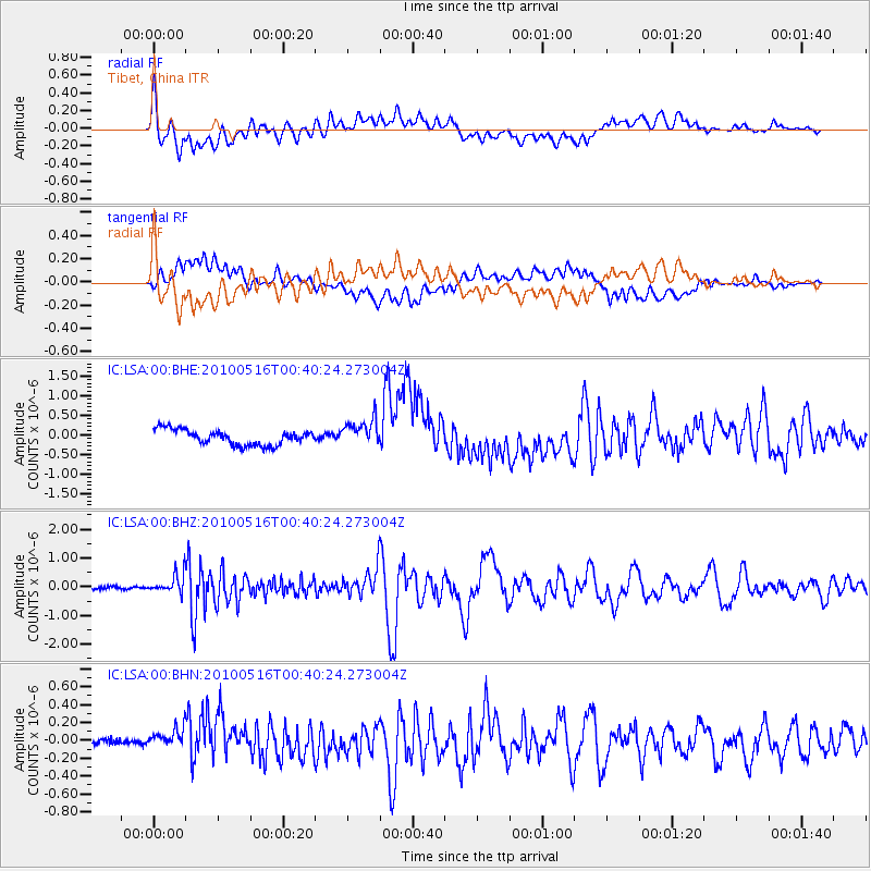
LSA Tibet, China - Earthquake Result Viewer
*The percent match for this event was below the threshold and hence no stack was calculated.
| Earthquake location: |
Minahassa Peninsula, Sulawesi |
| Earthquake latitude/longitude: |
0.5/124.7 |
| Earthquake time(UTC): |
2010/05/16 (136) 00:33:06 GMT |
| Earthquake Depth: |
123 km |
| Earthquake Magnitude: |
5.7 MB, 5.8 MW, 5.8 MW |
| Earthquake Catalog/Contributor: |
WHDF/NEIC |
|
| Network: |
IC New China Digital Seismograph Network |
| Station: |
LSA Tibet, China |
| Lat/Lon: |
29.70 N/91.15 E |
| Elevation: |
3789 m |
|
| Distance: |
43.1 deg |
| Az: |
315.367 deg |
| Baz: |
126.152 deg |
| Ray Param: |
$rayparam |
*The percent match for this event was below the threshold and hence was not used in the summary stack. |
|
| Radial Match: |
65.47156 % |
| Radial Bump: |
400 |
| Transverse Match: |
46.126133 % |
| Transverse Bump: |
400 |
| SOD ConfigId: |
314592 |
| Insert Time: |
2010-09-04 06:34:08.947 +0000 |
| GWidth: |
2.5 |
| Max Bumps: |
400 |
| Tol: |
0.001 |
|
Signal To Noise
| Channel | StoN | STA | LTA |
| IC:LSA:00:BHZ:20100516T00:40:24.273004Z | 4.7841344 | 3.4499172E-7 | 7.2111625E-8 |
| IC:LSA:00:BHN:20100516T00:40:24.273004Z | 3.1164827 | 1.15885506E-7 | 3.7184712E-8 |
| IC:LSA:00:BHE:20100516T00:40:24.273004Z | 1.766444 | 3.4252844E-7 | 1.9390845E-7 |
| Arrivals |
| Ps | |
| PpPs | |
| PsPs/PpSs | |


