You are here: Home > Network List > AK - Alaska Regional Network Stations List
> Station COLD Coldfoot Broadband > Earthquake Result Viewer
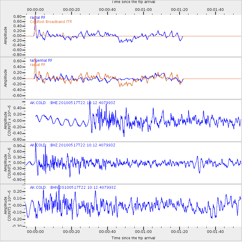
COLD Coldfoot Broadband - Earthquake Result Viewer
*The percent match for this event was below the threshold and hence no stack was calculated.
| Earthquake location: |
Kuril Islands |
| Earthquake latitude/longitude: |
46.3/152.0 |
| Earthquake time(UTC): |
2010/05/17 (137) 22:03:47 GMT |
| Earthquake Depth: |
73 km |
| Earthquake Magnitude: |
5.7 MB, 5.3 MW |
| Earthquake Catalog/Contributor: |
WHDF/NEIC |
|
| Network: |
AK Alaska Regional Network |
| Station: |
COLD Coldfoot Broadband |
| Lat/Lon: |
67.23 N/150.20 W |
| Elevation: |
377 m |
|
| Distance: |
36.1 deg |
| Az: |
33.951 deg |
| Baz: |
264.158 deg |
| Ray Param: |
$rayparam |
*The percent match for this event was below the threshold and hence was not used in the summary stack. |
|
| Radial Match: |
53.48745 % |
| Radial Bump: |
400 |
| Transverse Match: |
47.963078 % |
| Transverse Bump: |
400 |
| SOD ConfigId: |
314592 |
| Insert Time: |
2010-09-04 06:37:32.922 +0000 |
| GWidth: |
2.5 |
| Max Bumps: |
400 |
| Tol: |
0.001 |
|
Signal To Noise
| Channel | StoN | STA | LTA |
| AK:COLD: :BHZ:20100517T22:10:12.407993Z | 4.3546586 | 3.3162726E-7 | 7.615459E-8 |
| AK:COLD: :BHN:20100517T22:10:12.407993Z | 1.2756817 | 9.709512E-8 | 7.6112336E-8 |
| AK:COLD: :BHE:20100517T22:10:12.407993Z | 2.3076868 | 2.3378973E-7 | 1.01309126E-7 |
| Arrivals |
| Ps | |
| PpPs | |
| PsPs/PpSs | |


