You are here: Home > Network List > AK - Alaska Regional Network Stations List
> Station MDM Murphy Dome > Earthquake Result Viewer
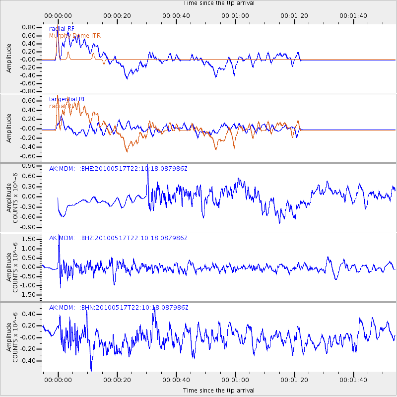
MDM Murphy Dome - Earthquake Result Viewer
*The percent match for this event was below the threshold and hence no stack was calculated.
| Earthquake location: |
Kuril Islands |
| Earthquake latitude/longitude: |
46.3/152.0 |
| Earthquake time(UTC): |
2010/05/17 (137) 22:03:47 GMT |
| Earthquake Depth: |
73 km |
| Earthquake Magnitude: |
5.7 MB, 5.3 MW |
| Earthquake Catalog/Contributor: |
WHDF/NEIC |
|
| Network: |
AK Alaska Regional Network |
| Station: |
MDM Murphy Dome |
| Lat/Lon: |
64.96 N/148.23 W |
| Elevation: |
634 m |
|
| Distance: |
36.8 deg |
| Az: |
37.857 deg |
| Baz: |
269.101 deg |
| Ray Param: |
$rayparam |
*The percent match for this event was below the threshold and hence was not used in the summary stack. |
|
| Radial Match: |
30.98845 % |
| Radial Bump: |
400 |
| Transverse Match: |
27.418703 % |
| Transverse Bump: |
400 |
| SOD ConfigId: |
314592 |
| Insert Time: |
2010-09-04 06:37:54.079 +0000 |
| GWidth: |
2.5 |
| Max Bumps: |
400 |
| Tol: |
0.001 |
|
Signal To Noise
| Channel | StoN | STA | LTA |
| AK:MDM: :BHZ:20100517T22:10:18.087986Z | 4.0334153 | 5.0296967E-7 | 1.2470069E-7 |
| AK:MDM: :BHN:20100517T22:10:18.087986Z | 0.9794675 | 1.6880726E-7 | 1.7234595E-7 |
| AK:MDM: :BHE:20100517T22:10:18.087986Z | 2.7307 | 3.8156568E-7 | 1.3973181E-7 |
| Arrivals |
| Ps | |
| PpPs | |
| PsPs/PpSs | |


