You are here: Home > Network List > CI - Caltech Regional Seismic Network Stations List
> Station BFS Mt Baldy Forest Station > Earthquake Result Viewer
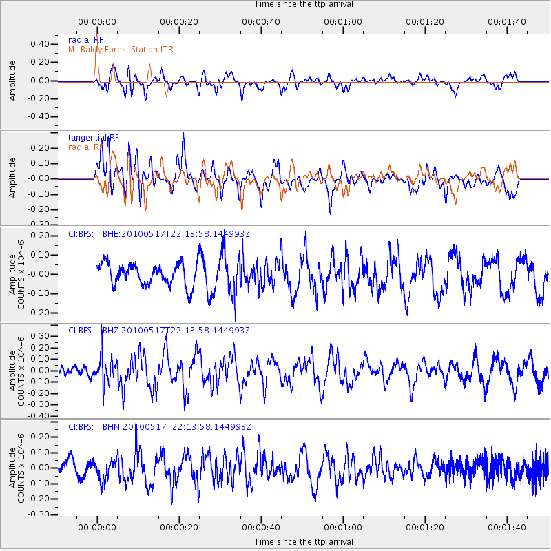
BFS Mt Baldy Forest Station - Earthquake Result Viewer
*The percent match for this event was below the threshold and hence no stack was calculated.
| Earthquake location: |
Kuril Islands |
| Earthquake latitude/longitude: |
46.3/152.0 |
| Earthquake time(UTC): |
2010/05/17 (137) 22:03:47 GMT |
| Earthquake Depth: |
73 km |
| Earthquake Magnitude: |
5.7 MB, 5.3 MW |
| Earthquake Catalog/Contributor: |
WHDF/NEIC |
|
| Network: |
CI Caltech Regional Seismic Network |
| Station: |
BFS Mt Baldy Forest Station |
| Lat/Lon: |
34.24 N/117.66 W |
| Elevation: |
1312 m |
|
| Distance: |
66.4 deg |
| Az: |
64.691 deg |
| Baz: |
310.828 deg |
| Ray Param: |
$rayparam |
*The percent match for this event was below the threshold and hence was not used in the summary stack. |
|
| Radial Match: |
58.94083 % |
| Radial Bump: |
400 |
| Transverse Match: |
64.394035 % |
| Transverse Bump: |
400 |
| SOD ConfigId: |
314592 |
| Insert Time: |
2010-09-04 06:40:29.591 +0000 |
| GWidth: |
2.5 |
| Max Bumps: |
400 |
| Tol: |
0.001 |
|
Signal To Noise
| Channel | StoN | STA | LTA |
| CI:BFS: :BHZ:20100517T22:13:58.144993Z | 2.5913475 | 1.2370401E-7 | 4.7737334E-8 |
| CI:BFS: :BHN:20100517T22:13:58.144993Z | 1.0756421 | 6.357621E-8 | 5.910535E-8 |
| CI:BFS: :BHE:20100517T22:13:58.144993Z | 1.9040413 | 1.0547294E-7 | 5.5394253E-8 |
| Arrivals |
| Ps | |
| PpPs | |
| PsPs/PpSs | |


