You are here: Home > Network List > CI - Caltech Regional Seismic Network Stations List
> Station TUQ Turquiose Mountain, Baker, CA, USA > Earthquake Result Viewer
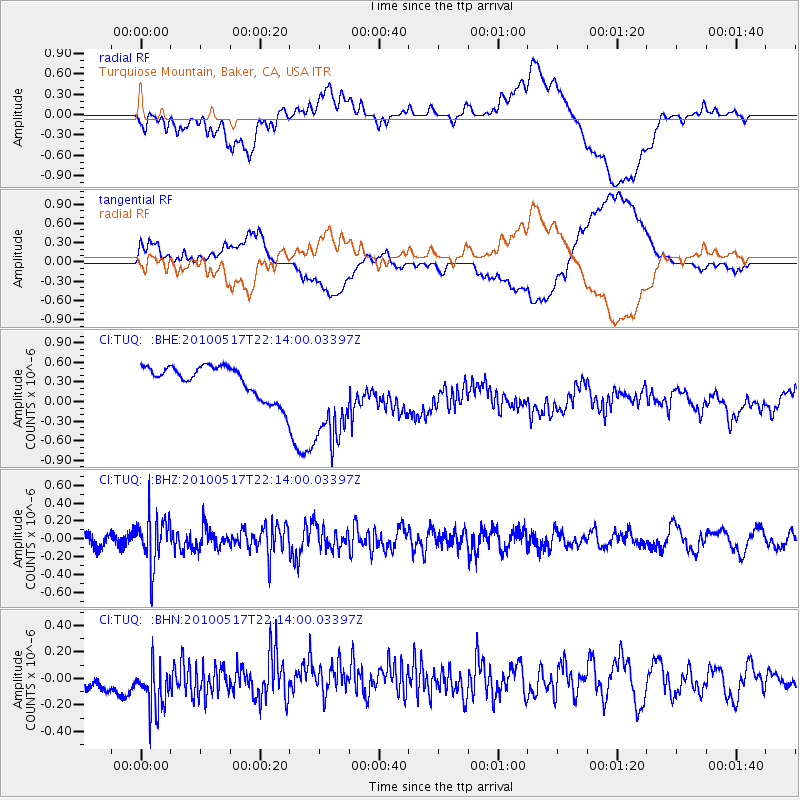
TUQ Turquiose Mountain, Baker, CA, USA - Earthquake Result Viewer
*The percent match for this event was below the threshold and hence no stack was calculated.
| Earthquake location: |
Kuril Islands |
| Earthquake latitude/longitude: |
46.3/152.0 |
| Earthquake time(UTC): |
2010/05/17 (137) 22:03:47 GMT |
| Earthquake Depth: |
73 km |
| Earthquake Magnitude: |
5.7 MB, 5.3 MW |
| Earthquake Catalog/Contributor: |
WHDF/NEIC |
|
| Network: |
CI Caltech Regional Seismic Network |
| Station: |
TUQ Turquiose Mountain, Baker, CA, USA |
| Lat/Lon: |
35.44 N/115.92 W |
| Elevation: |
1350 m |
|
| Distance: |
66.7 deg |
| Az: |
62.688 deg |
| Baz: |
311.018 deg |
| Ray Param: |
$rayparam |
*The percent match for this event was below the threshold and hence was not used in the summary stack. |
|
| Radial Match: |
40.69303 % |
| Radial Bump: |
400 |
| Transverse Match: |
35.245094 % |
| Transverse Bump: |
400 |
| SOD ConfigId: |
314592 |
| Insert Time: |
2010-09-04 06:40:44.128 +0000 |
| GWidth: |
2.5 |
| Max Bumps: |
400 |
| Tol: |
0.001 |
|
Signal To Noise
| Channel | StoN | STA | LTA |
| CI:TUQ: :BHZ:20100517T22:14:00.03397Z | 3.479945 | 2.8034984E-7 | 8.056158E-8 |
| CI:TUQ: :BHN:20100517T22:14:00.03397Z | 2.773233 | 2.1361315E-7 | 7.702676E-8 |
| CI:TUQ: :BHE:20100517T22:14:00.03397Z | 3.1928895 | 7.7616403E-7 | 2.4309142E-7 |
| Arrivals |
| Ps | |
| PpPs | |
| PsPs/PpSs | |


