You are here: Home > Network List > CI - Caltech Regional Seismic Network Stations List
> Station FMP Fort MacArthur Park, Pt. Fermin San Pedro, CA, USA > Earthquake Result Viewer
FMP Fort MacArthur Park, Pt. Fermin San Pedro, CA, USA - Earthquake Result Viewer

| Earthquake location: |
South Of Fiji Islands |
| Earthquake latitude/longitude: |
-23.0/-177.2 |
| Earthquake time(UTC): |
2023/06/15 (166) 18:06:27 GMT |
| Earthquake Depth: |
167 km |
| Earthquake Magnitude: |
7.2 Mww |
| Earthquake Catalog/Contributor: |
NEIC PDE/us |
|
| Network: |
CI Caltech Regional Seismic Network |
| Station: |
FMP Fort MacArthur Park, Pt. Fermin San Pedro, CA, USA |
| Lat/Lon: |
33.71 N/118.29 W |
| Elevation: |
89 m |
|
| Distance: |
79.5 deg |
| Az: |
46.551 deg |
| Baz: |
233.383 deg |
| Ray Param: |
0.048513472 |
| Estimated Moho Depth: |
35.75 km |
| Estimated Crust Vp/Vs: |
2.01 |
| Assumed Crust Vp: |
6.048 km/s |
| Estimated Crust Vs: |
3.005 km/s |
| Estimated Crust Poisson's Ratio: |
0.34 |
|
| Radial Match: |
93.80536 % |
| Radial Bump: |
400 |
| Transverse Match: |
89.959145 % |
| Transverse Bump: |
400 |
| SOD ConfigId: |
30536071 |
| Insert Time: |
2023-06-29 18:48:27.828 +0000 |
| GWidth: |
2.5 |
| Max Bumps: |
400 |
| Tol: |
0.001 |
|
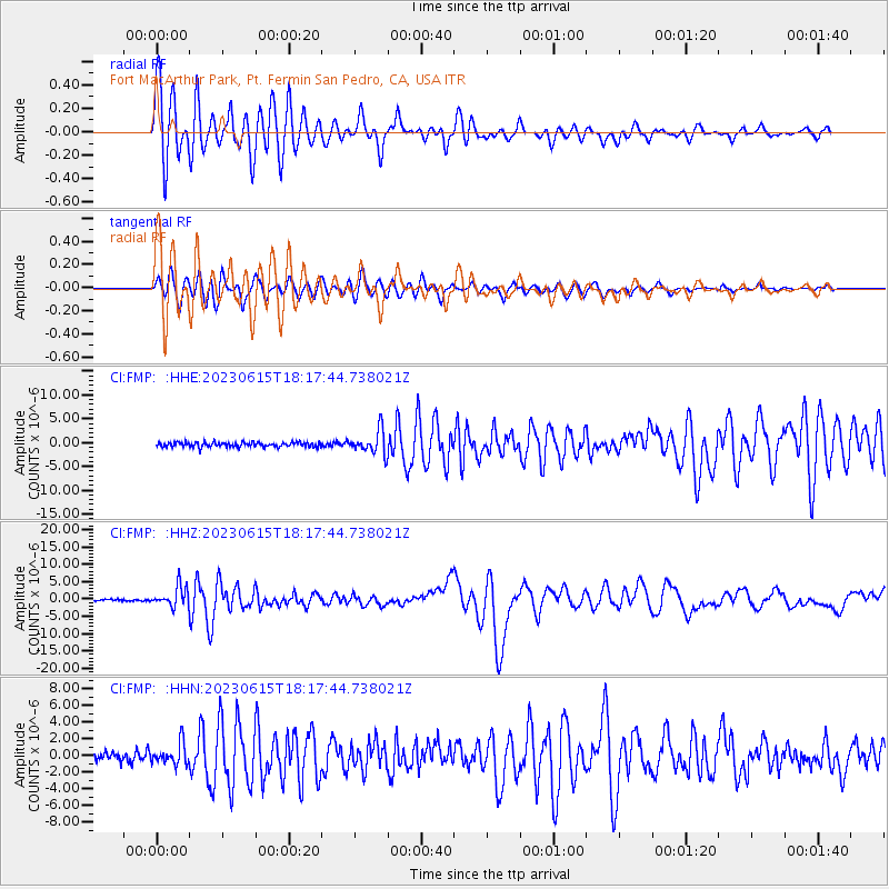
Signal To Noise
| Channel | StoN | STA | LTA |
| CI:FMP: :HHZ:20230615T18:17:44.738021Z | 13.299338 | 2.9318867E-6 | 2.2045357E-7 |
| CI:FMP: :HHN:20230615T18:17:44.738021Z | 3.2865443 | 1.2875979E-6 | 3.9177863E-7 |
| CI:FMP: :HHE:20230615T18:17:44.738021Z | 5.0773363 | 2.4617257E-6 | 4.848459E-7 |
| Arrivals |
| Ps | 6.1 SECOND |
| PpPs | 17 SECOND |
| PsPs/PpSs | 24 SECOND |


