You are here: Home > Network List > IC - New China Digital Seismograph Network Stations List
> Station LSA Tibet, China > Earthquake Result Viewer
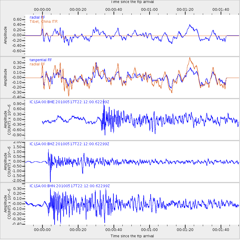
LSA Tibet, China - Earthquake Result Viewer
*The percent match for this event was below the threshold and hence no stack was calculated.
| Earthquake location: |
Kuril Islands |
| Earthquake latitude/longitude: |
46.3/152.0 |
| Earthquake time(UTC): |
2010/05/17 (137) 22:03:47 GMT |
| Earthquake Depth: |
73 km |
| Earthquake Magnitude: |
5.7 MB, 5.3 MW |
| Earthquake Catalog/Contributor: |
WHDF/NEIC |
|
| Network: |
IC New China Digital Seismograph Network |
| Station: |
LSA Tibet, China |
| Lat/Lon: |
29.70 N/91.15 E |
| Elevation: |
3789 m |
|
| Distance: |
49.5 deg |
| Az: |
272.758 deg |
| Baz: |
52.756 deg |
| Ray Param: |
$rayparam |
*The percent match for this event was below the threshold and hence was not used in the summary stack. |
|
| Radial Match: |
62.119217 % |
| Radial Bump: |
400 |
| Transverse Match: |
64.61423 % |
| Transverse Bump: |
400 |
| SOD ConfigId: |
314592 |
| Insert Time: |
2010-09-04 06:41:34.315 +0000 |
| GWidth: |
2.5 |
| Max Bumps: |
400 |
| Tol: |
0.001 |
|
Signal To Noise
| Channel | StoN | STA | LTA |
| IC:LSA:00:BHZ:20100517T22:12:00.62299Z | 9.568282 | 4.8707636E-7 | 5.090531E-8 |
| IC:LSA:00:BHN:20100517T22:12:00.62299Z | 4.1332364 | 8.2356955E-8 | 1.9925537E-8 |
| IC:LSA:00:BHE:20100517T22:12:00.62299Z | 2.3970945 | 2.7546412E-7 | 1.1491583E-7 |
| Arrivals |
| Ps | |
| PpPs | |
| PsPs/PpSs | |


