You are here: Home > Network List > US - United States National Seismic Network Stations List
> Station DGMT Dagmar, Montana, USA > Earthquake Result Viewer
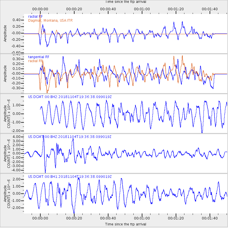
DGMT Dagmar, Montana, USA - Earthquake Result Viewer
*The percent match for this event was below the threshold and hence no stack was calculated.
| Earthquake location: |
Hokkaido, Japan Region |
| Earthquake latitude/longitude: |
44.6/145.6 |
| Earthquake time(UTC): |
2018/11/04 (308) 19:26:03 GMT |
| Earthquake Depth: |
8.0 km |
| Earthquake Magnitude: |
5.9 Mww |
| Earthquake Catalog/Contributor: |
NEIC PDE/us |
|
| Network: |
US United States National Seismic Network |
| Station: |
DGMT Dagmar, Montana, USA |
| Lat/Lon: |
48.47 N/104.20 W |
| Elevation: |
0.0 m |
|
| Distance: |
69.0 deg |
| Az: |
41.971 deg |
| Baz: |
314.085 deg |
| Ray Param: |
$rayparam |
*The percent match for this event was below the threshold and hence was not used in the summary stack. |
|
| Radial Match: |
66.64598 % |
| Radial Bump: |
400 |
| Transverse Match: |
56.399178 % |
| Transverse Bump: |
400 |
| SOD ConfigId: |
3131071 |
| Insert Time: |
2018-11-18 19:38:08.568 +0000 |
| GWidth: |
2.5 |
| Max Bumps: |
400 |
| Tol: |
0.001 |
|
Signal To Noise
| Channel | StoN | STA | LTA |
| US:DGMT:00:BHZ:20181104T19:36:38.099019Z | 7.293008 | 2.0061384E-6 | 2.7507693E-7 |
| US:DGMT:00:BH1:20181104T19:36:38.099019Z | 1.8419473 | 1.2545471E-6 | 6.810982E-7 |
| US:DGMT:00:BH2:20181104T19:36:38.099019Z | 0.91463363 | 8.7762237E-7 | 9.595343E-7 |
| Arrivals |
| Ps | |
| PpPs | |
| PsPs/PpSs | |


