You are here: Home > Network List > IU - Global Seismograph Network (GSN - IRIS/USGS) Stations List
> Station PMG Port Moresby, New Guinea > Earthquake Result Viewer
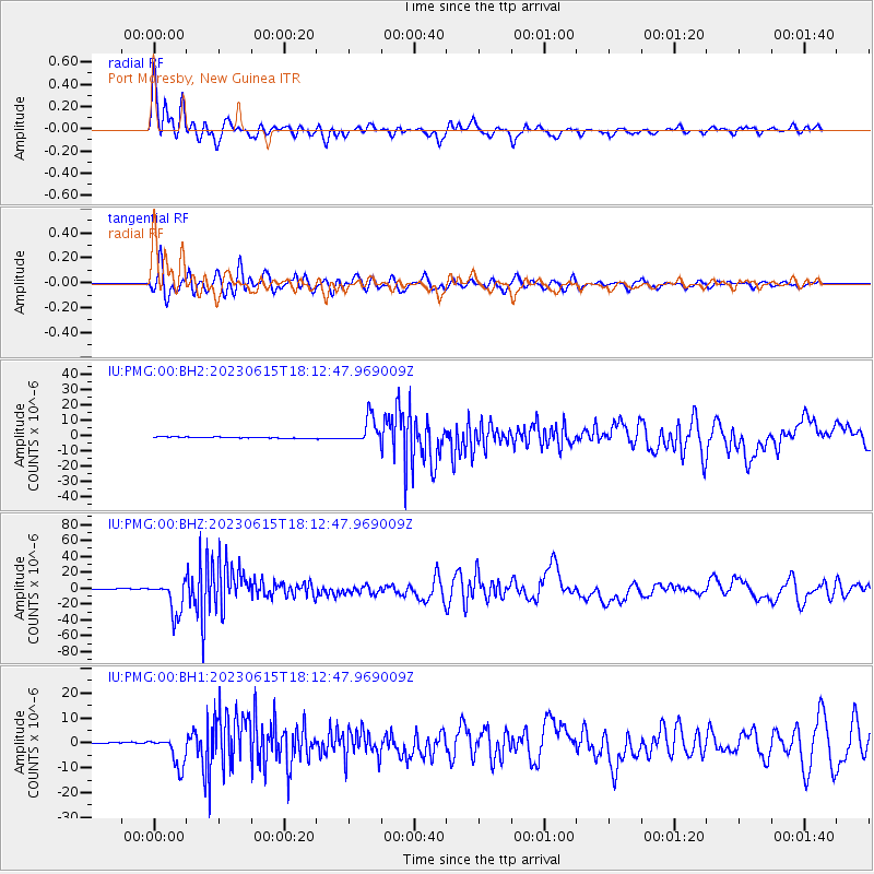
PMG Port Moresby, New Guinea - Earthquake Result Viewer
*The percent match for this event was below the threshold and hence no stack was calculated.
| Earthquake location: |
South Of Fiji Islands |
| Earthquake latitude/longitude: |
-23.0/-177.2 |
| Earthquake time(UTC): |
2023/06/15 (166) 18:06:27 GMT |
| Earthquake Depth: |
167 km |
| Earthquake Magnitude: |
7.2 Mww |
| Earthquake Catalog/Contributor: |
NEIC PDE/us |
|
| Network: |
IU Global Seismograph Network (GSN - IRIS/USGS) |
| Station: |
PMG Port Moresby, New Guinea |
| Lat/Lon: |
9.40 S/147.16 E |
| Elevation: |
90 m |
|
| Distance: |
36.7 deg |
| Az: |
285.715 deg |
| Baz: |
115.968 deg |
| Ray Param: |
$rayparam |
*The percent match for this event was below the threshold and hence was not used in the summary stack. |
|
| Radial Match: |
91.90184 % |
| Radial Bump: |
400 |
| Transverse Match: |
86.33342 % |
| Transverse Bump: |
400 |
| SOD ConfigId: |
30536071 |
| Insert Time: |
2023-06-29 18:54:45.346 +0000 |
| GWidth: |
2.5 |
| Max Bumps: |
400 |
| Tol: |
0.001 |
|
Signal To Noise
| Channel | StoN | STA | LTA |
| IU:PMG:00:BHZ:20230615T18:12:47.969009Z | 44.60989 | 2.0985264E-5 | 4.7041732E-7 |
| IU:PMG:00:BH1:20230615T18:12:47.969009Z | 27.605827 | 6.0835014E-6 | 2.203702E-7 |
| IU:PMG:00:BH2:20230615T18:12:47.969009Z | 22.88731 | 8.384068E-6 | 3.6631948E-7 |
| Arrivals |
| Ps | |
| PpPs | |
| PsPs/PpSs | |


