You are here: Home > Network List > KN - Kyrgyz Seismic Telemetry Network Stations List
> Station KBK KN.KBK > Earthquake Result Viewer
KBK KN.KBK - Earthquake Result Viewer
*The percent match for this event was below the threshold and hence no stack was calculated.
| Earthquake location: |
Kuril Islands |
| Earthquake latitude/longitude: |
46.3/152.0 |
| Earthquake time(UTC): |
2010/05/17 (137) 22:03:47 GMT |
| Earthquake Depth: |
73 km |
| Earthquake Magnitude: |
5.7 MB, 5.3 MW |
| Earthquake Catalog/Contributor: |
WHDF/NEIC |
|
| Network: |
KN Kyrgyz Seismic Telemetry Network |
| Station: |
KBK KN.KBK |
| Lat/Lon: |
42.66 N/74.95 E |
| Elevation: |
1760 m |
|
| Distance: |
53.1 deg |
| Az: |
295.905 deg |
| Baz: |
57.73 deg |
| Ray Param: |
$rayparam |
*The percent match for this event was below the threshold and hence was not used in the summary stack. |
|
| Radial Match: |
63.577953 % |
| Radial Bump: |
400 |
| Transverse Match: |
68.56153 % |
| Transverse Bump: |
400 |
| SOD ConfigId: |
314592 |
| Insert Time: |
2010-09-04 06:44:10.676 +0000 |
| GWidth: |
2.5 |
| Max Bumps: |
400 |
| Tol: |
0.001 |
|
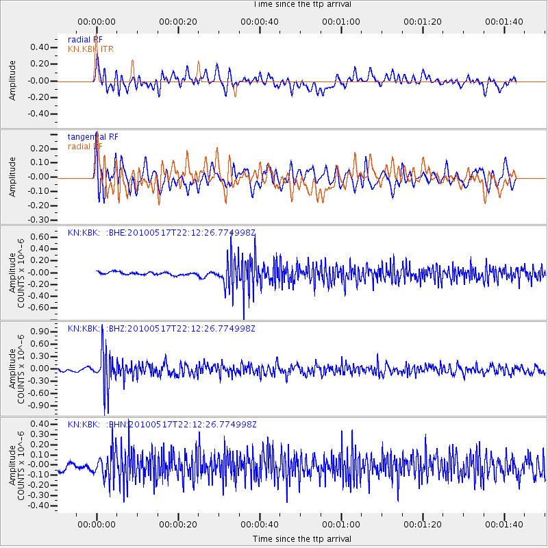
Signal To Noise
| Channel | StoN | STA | LTA |
| KN:KBK: :BHZ:20100517T22:12:26.774998Z | 8.43914 | 4.357107E-7 | 5.1629748E-8 |
| KN:KBK: :BHN:20100517T22:12:26.774998Z | 3.585662 | 1.3882995E-7 | 3.8718078E-8 |
| KN:KBK: :BHE:20100517T22:12:26.774998Z | 10.653519 | 2.468381E-7 | 2.3169632E-8 |
| Arrivals |
| Ps | |
| PpPs | |
| PsPs/PpSs | |


