You are here: Home > Network List > TA - USArray Transportable Network (new EarthScope stations) Stations List
> Station F21A Absaloka Mine, Hardin, MT, USA > Earthquake Result Viewer
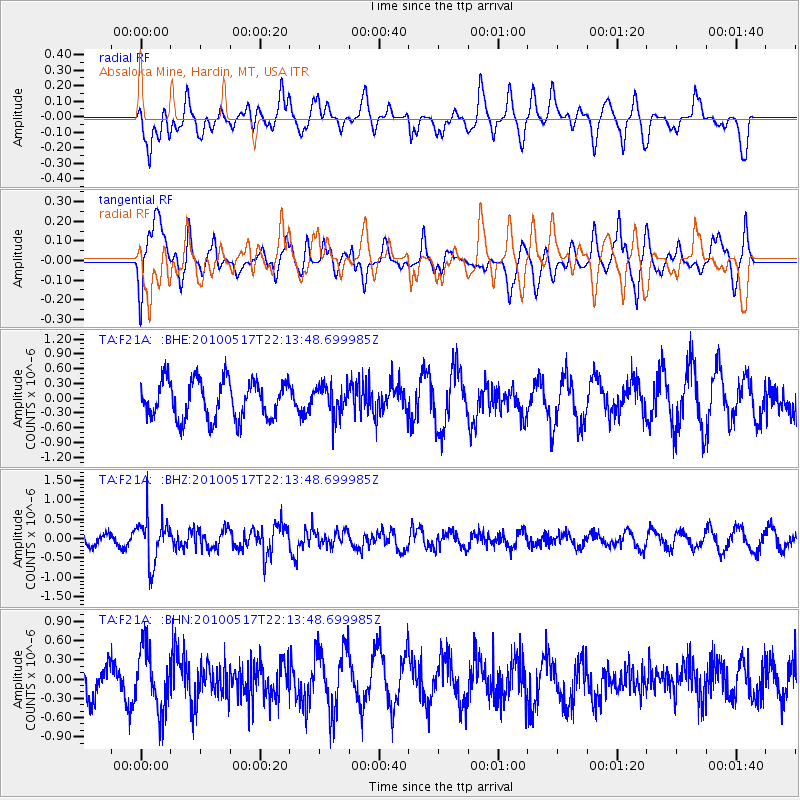
F21A Absaloka Mine, Hardin, MT, USA - Earthquake Result Viewer
*The percent match for this event was below the threshold and hence no stack was calculated.
| Earthquake location: |
Kuril Islands |
| Earthquake latitude/longitude: |
46.3/152.0 |
| Earthquake time(UTC): |
2010/05/17 (137) 22:03:47 GMT |
| Earthquake Depth: |
73 km |
| Earthquake Magnitude: |
5.7 MB, 5.3 MW |
| Earthquake Catalog/Contributor: |
WHDF/NEIC |
|
| Network: |
TA USArray Transportable Network (new EarthScope stations) |
| Station: |
F21A Absaloka Mine, Hardin, MT, USA |
| Lat/Lon: |
45.82 N/107.12 W |
| Elevation: |
1026 m |
|
| Distance: |
64.9 deg |
| Az: |
49.303 deg |
| Baz: |
311.251 deg |
| Ray Param: |
$rayparam |
*The percent match for this event was below the threshold and hence was not used in the summary stack. |
|
| Radial Match: |
66.692154 % |
| Radial Bump: |
400 |
| Transverse Match: |
49.462715 % |
| Transverse Bump: |
400 |
| SOD ConfigId: |
314592 |
| Insert Time: |
2010-09-04 06:49:16.681 +0000 |
| GWidth: |
2.5 |
| Max Bumps: |
400 |
| Tol: |
0.001 |
|
Signal To Noise
| Channel | StoN | STA | LTA |
| TA:F21A: :BHZ:20100517T22:13:48.699985Z | 2.1259367 | 5.894866E-7 | 2.7728322E-7 |
| TA:F21A: :BHN:20100517T22:13:48.699985Z | 1.5865386 | 4.722782E-7 | 2.9767838E-7 |
| TA:F21A: :BHE:20100517T22:13:48.699985Z | 0.77758276 | 3.0086858E-7 | 3.8692804E-7 |
| Arrivals |
| Ps | |
| PpPs | |
| PsPs/PpSs | |


