You are here: Home > Network List > TA - USArray Transportable Network (new EarthScope stations) Stations List
> Station A21A Bergtoll Ranch, Theony, MT, USA > Earthquake Result Viewer
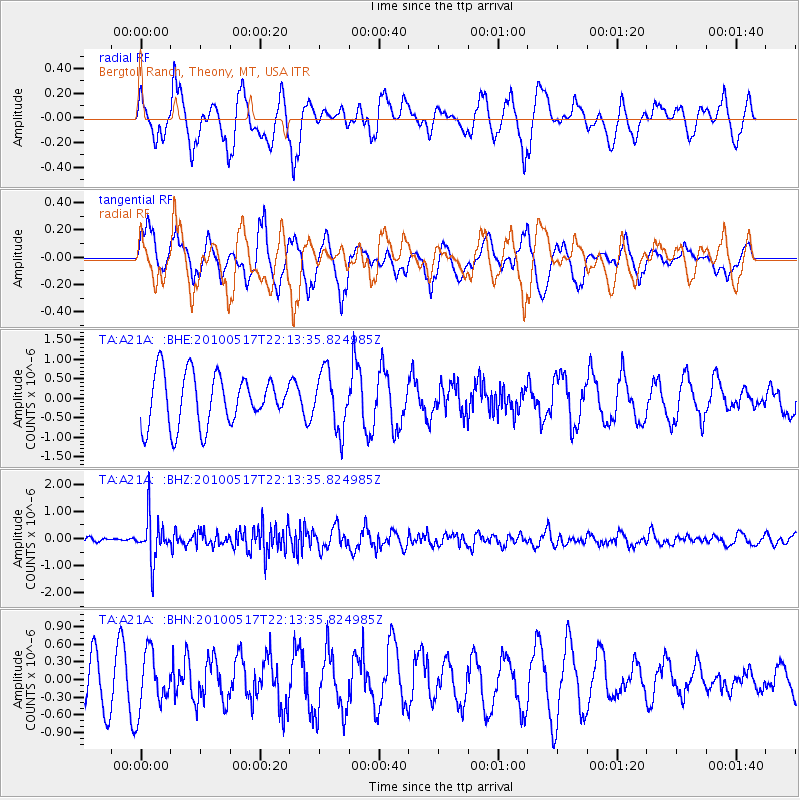
A21A Bergtoll Ranch, Theony, MT, USA - Earthquake Result Viewer
*The percent match for this event was below the threshold and hence no stack was calculated.
| Earthquake location: |
Kuril Islands |
| Earthquake latitude/longitude: |
46.3/152.0 |
| Earthquake time(UTC): |
2010/05/17 (137) 22:03:47 GMT |
| Earthquake Depth: |
73 km |
| Earthquake Magnitude: |
5.7 MB, 5.3 MW |
| Earthquake Catalog/Contributor: |
WHDF/NEIC |
|
| Network: |
TA USArray Transportable Network (new EarthScope stations) |
| Station: |
A21A Bergtoll Ranch, Theony, MT, USA |
| Lat/Lon: |
48.99 N/106.93 W |
| Elevation: |
779 m |
|
| Distance: |
63.0 deg |
| Az: |
46.531 deg |
| Baz: |
310.179 deg |
| Ray Param: |
$rayparam |
*The percent match for this event was below the threshold and hence was not used in the summary stack. |
|
| Radial Match: |
55.5431 % |
| Radial Bump: |
400 |
| Transverse Match: |
42.361103 % |
| Transverse Bump: |
393 |
| SOD ConfigId: |
314592 |
| Insert Time: |
2010-09-04 06:51:00.389 +0000 |
| GWidth: |
2.5 |
| Max Bumps: |
400 |
| Tol: |
0.001 |
|
Signal To Noise
| Channel | StoN | STA | LTA |
| TA:A21A: :BHZ:20100517T22:13:35.824985Z | 5.268019 | 7.919384E-7 | 1.5032944E-7 |
| TA:A21A: :BHN:20100517T22:13:35.824985Z | 1.4905318 | 4.797108E-7 | 3.218387E-7 |
| TA:A21A: :BHE:20100517T22:13:35.824985Z | 1.1334679 | 7.3954226E-7 | 6.524598E-7 |
| Arrivals |
| Ps | |
| PpPs | |
| PsPs/PpSs | |


